
Edakkal Caves and the Story of Wayanad: Stone Age Carvings to Pazhassi Raja
A cleft in a mountain covered with ancient engravings, an inscription of a king called Vishnuvarman, a police officer's notes of 1901, and Wayanad's long history from Jain merchants and Tipu Sultan to the forest war of Pazhassi Raja.
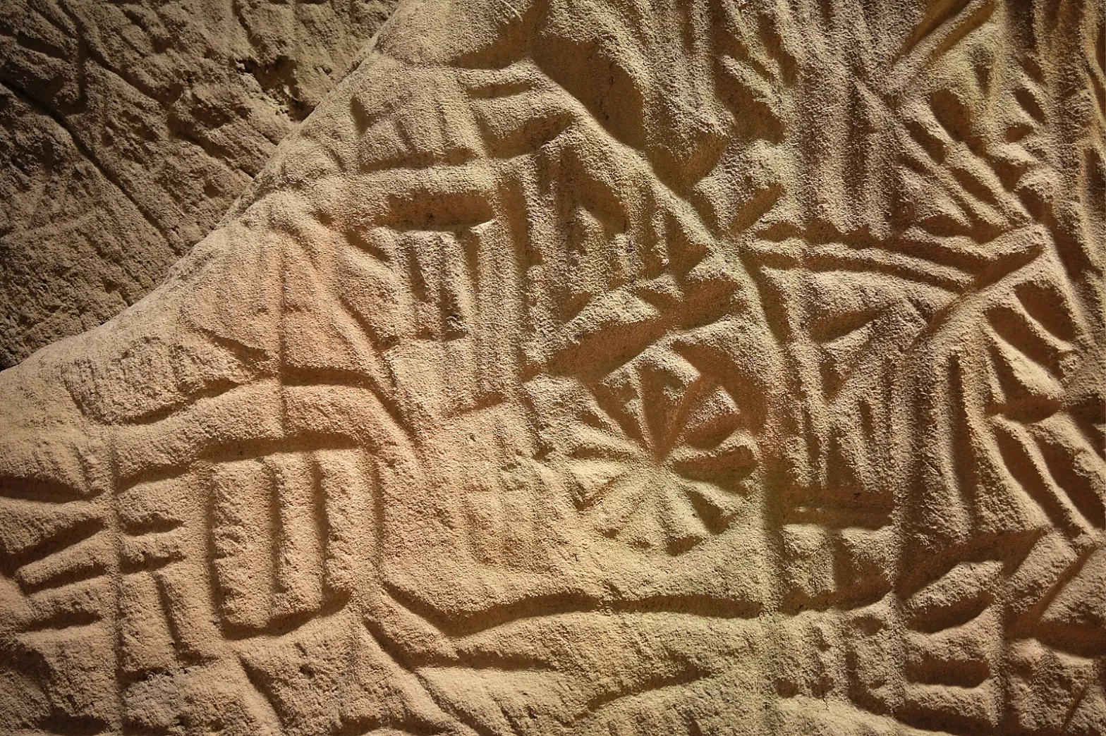
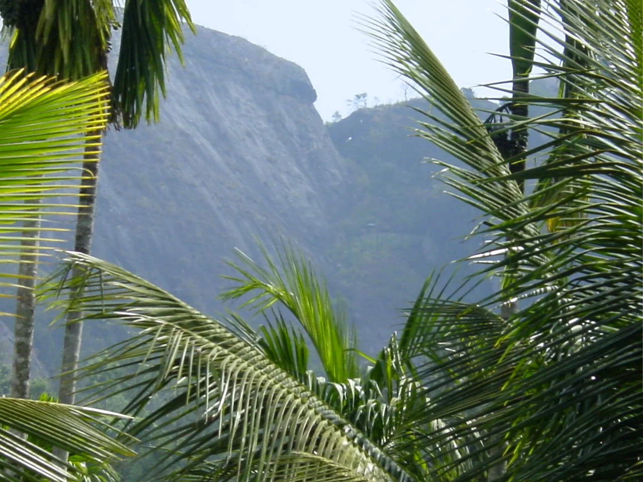
High on a granite hill in Wayanad, a giant boulder once split away from the mountain, and another fell across the gap like a roof. The result is not really a cave but a tall, narrow cleft in the rock, lit from above. On its walls, scraped into the stone, are hundreds of figures: people with strange tufted headdresses, animals, wheels, grids, spirals and signs no one has yet read. Among them, much later, someone wrote a few lines in ancient letters.
These are the Edakkal Caves, one of the oldest galleries of human imagery in South India, and the best place to begin a story of Wayanad, Kerala's highland district on the borders of Karnataka and Tamil Nadu. In this article we tell how the caves came to the attention of the world, what the carvings and inscriptions show, and how much of what is said about them is proven; and we follow the history of Wayanad down to its forest rebel king, Pazhassi Raja. As always, our own assessments are clearly marked.
At a glance
- Where: on Ambukuthi Mala (Edakkal hill), near Ambalavayal, about 12 km from Sultan Bathery, Wayanad district.
- Height: the caves lie at about 1,200 m (3,900 ft) above sea level, near the crest of the hill.
- What: a rock cleft about 29 m long and 6–7 m wide, roofed by fallen boulders, with engraved walls and a few ancient inscriptions.
- Age: the engravings are widely dated from the Neolithic to the Iron Age; the oldest claims go back several thousand years before Christ, but there is no scientific date (see our assessment).
- First published: by F. Fawcett, Superintendent of Police, Malabar, in The Indian Antiquary, 1901.
- Name: Edakkal means 'the stone in between', after the boulder wedged across the cleft.
The land of paddy fields
The name Wayanad is usually explained as vayal nadu, 'the land of paddy fields', and the high plateau, about 700 to 2,100 metres above the sea, is still a country of rice fields in its valleys, with coffee, pepper, tea and cardamom on its slopes and some of Kerala's richest forests along its borders. Its oldest inhabitants are its tribal communities, among them the Paniya, Kurichiya, Kuruma (Kurumbar), Adiya and Kattunaikka. Wayanad has the largest Adivasi population of any district in Kerala.
The plateau was also a road. Old paths ran from the Mysore plateau down through Wayanad's passes to the ports of the Malabar coast, carrying spices west and goods east. The great rock with its engraved cleft stands within sight of these routes, and the stone circles and burial monuments of Wayanad's Iron Age people are scattered across the same country.
'Notes on the rock carvings': an officer's discovery
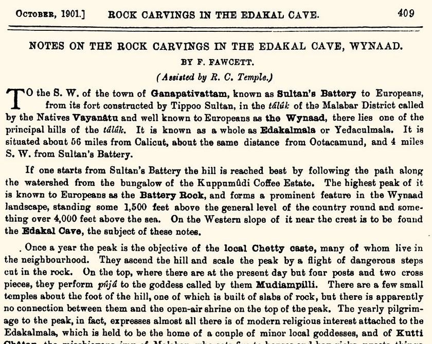
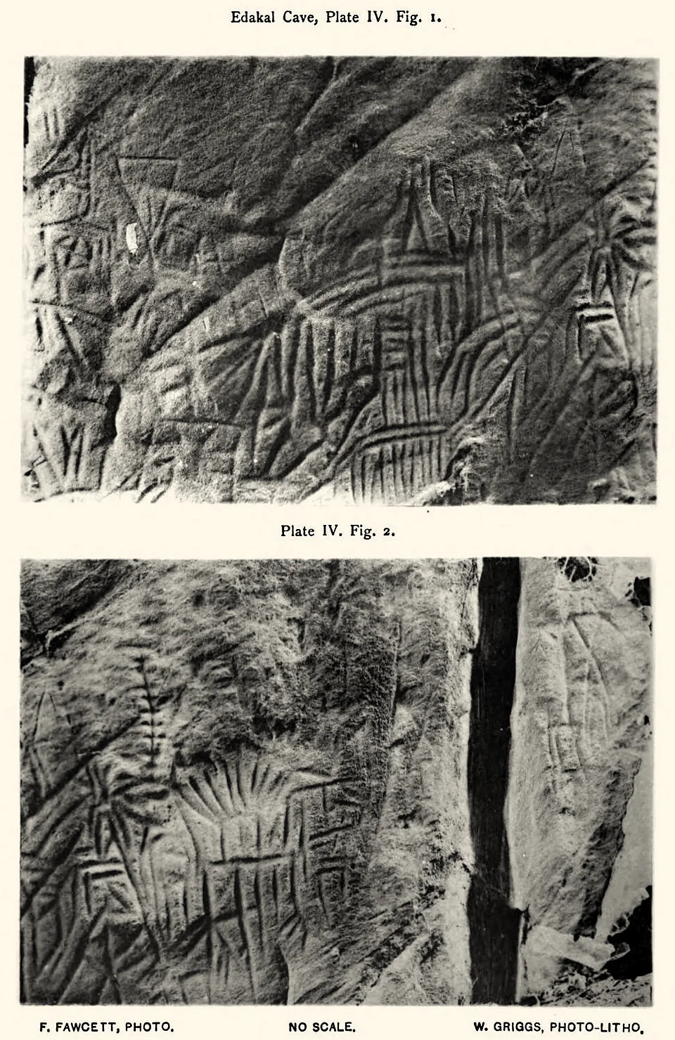
The caves came to the notice of scholars through a British police officer, Fred Fawcett, Superintendent of Police in Malabar, who had a keen interest in anthropology. In October 1901 he published 'Notes on the Rock Carvings in the Edakal Cave, Wynaad' in The Indian Antiquary, the leading journal of Indian studies of the day, with his own photographs. His article is still the starting point for everything written about Edakkal.
Read today, the article is full of surprises:
- Fawcett did not claim to have discovered the cave. The epigraphist E. Hultzsch had written that Fawcett discovered it in 1896, but Fawcett corrected him in print: 'Dr. Hultzsch... does me too much honour', he wrote; the cave's existence had been known to residents of the neighbourhood for twelve or fifteen years before. His own first visit was in the last days of 1894; he returned at the end of 1895 and the beginning of 1896.
- The floor was buried. On his first visit the lower part of the carvings was hidden under several feet of soft earth. On the second, with labourers, he had it dug out to photograph the walls in full, and found nothing else in it down to about seven feet. He argued, sensibly, that such a depth of earth, washed in through the rocks over a very long time, showed that the carvings were very old.
- The people of the hills treated it differently. None of the local Kurumbar, he noted, would approach the cave: they seemed to hold it in a reverence they wished to hide. The Paniyas had no such feeling, and it was they who dug out the floor.
- The carvings were scraped, not chiselled. The geologist Robert Bruce Foote, the father of Indian prehistory, pointed out to Fawcett that the figures had been scraped into the rock rather than chipped or cut.
- The legends. Fawcett recorded that the hill was the home of local goddesses and of Kutti Chathan, the mischievous spirit, who killed a great serpent with an arrow; the arrow was shown as a long stone in a paddy field at the foot of the hill, called Ambukuttivayal, 'the field where the arrow struck'. This is the origin of the hill's name today, Ambukuthi Mala, 'the hill of the arrow-strike'.
Our assessment: who 'discovered' Edakkal?
Popular accounts say that Fawcett 'discovered' the caves in 1890, often during a hunting trip. His own article tells a different and more honest story: the cave was well known to the people of the hill, and his first visit was in December 1894. We have not found a primary source for the year 1890. What Fawcett did was to bring the cave to the attention of scholars, by photographing it, clearing its floor and publishing it with the help of the leading epigraphist of the day. That is achievement enough. The people who knew the cave first, and the Kurumbar who held it in reverence, are the real discoverers, and the old belief that the hill was sacred may well be a memory of its ancient use.
The cleft and its carvings
Fawcett described the place precisely: 'The Edakal Cave is not a cave in the ordinary sense of the word. It is properly a cleft about 96 feet long and 20 to 22 feet wide in the rock', formed when a corner of the rock split away from the main body, with 'an enormous rock weighing several hundred tons' fallen across it as a roof. Today visitors climb a steep path and iron steps to reach two chambers, the upper one with the engravings.
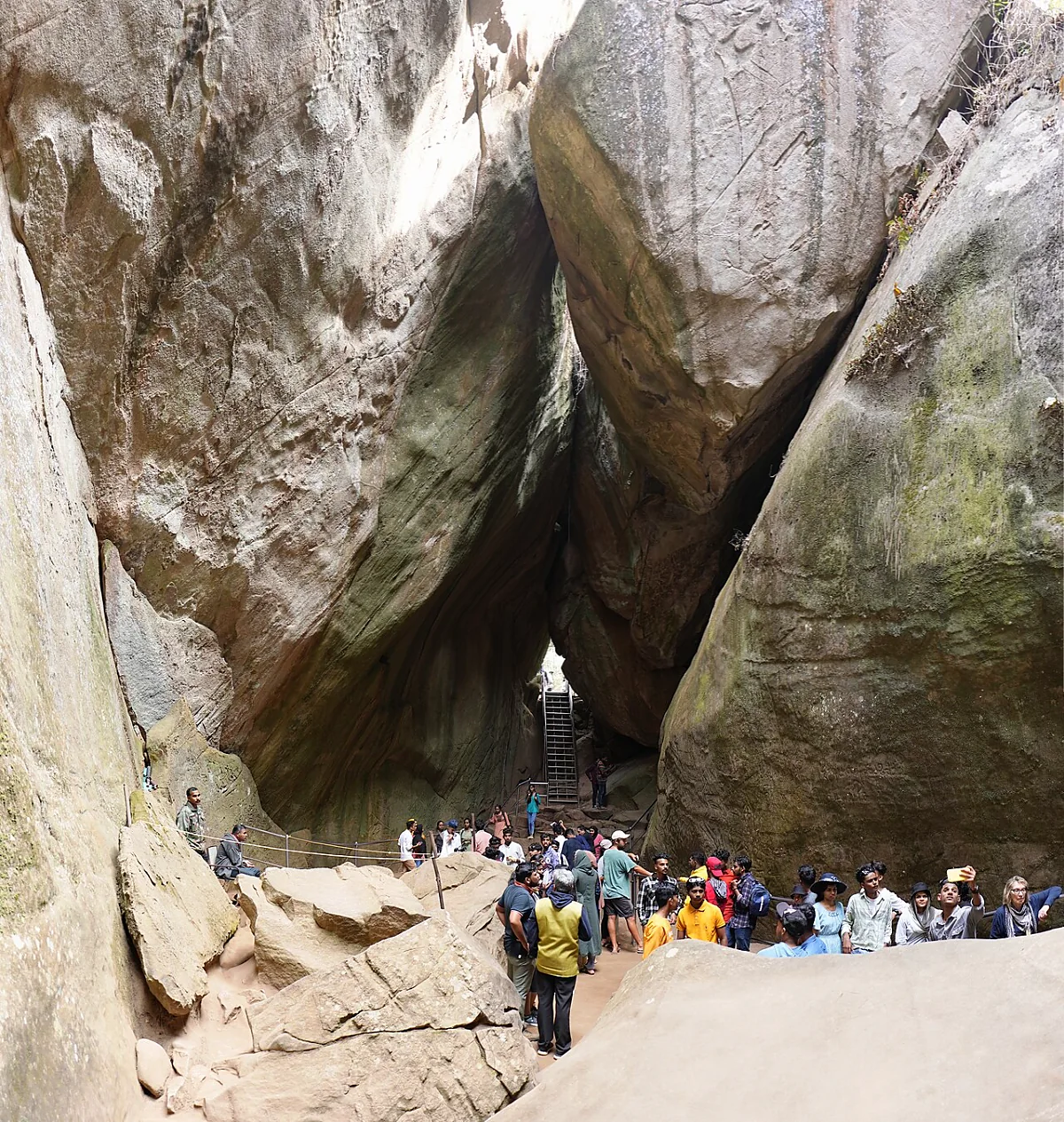
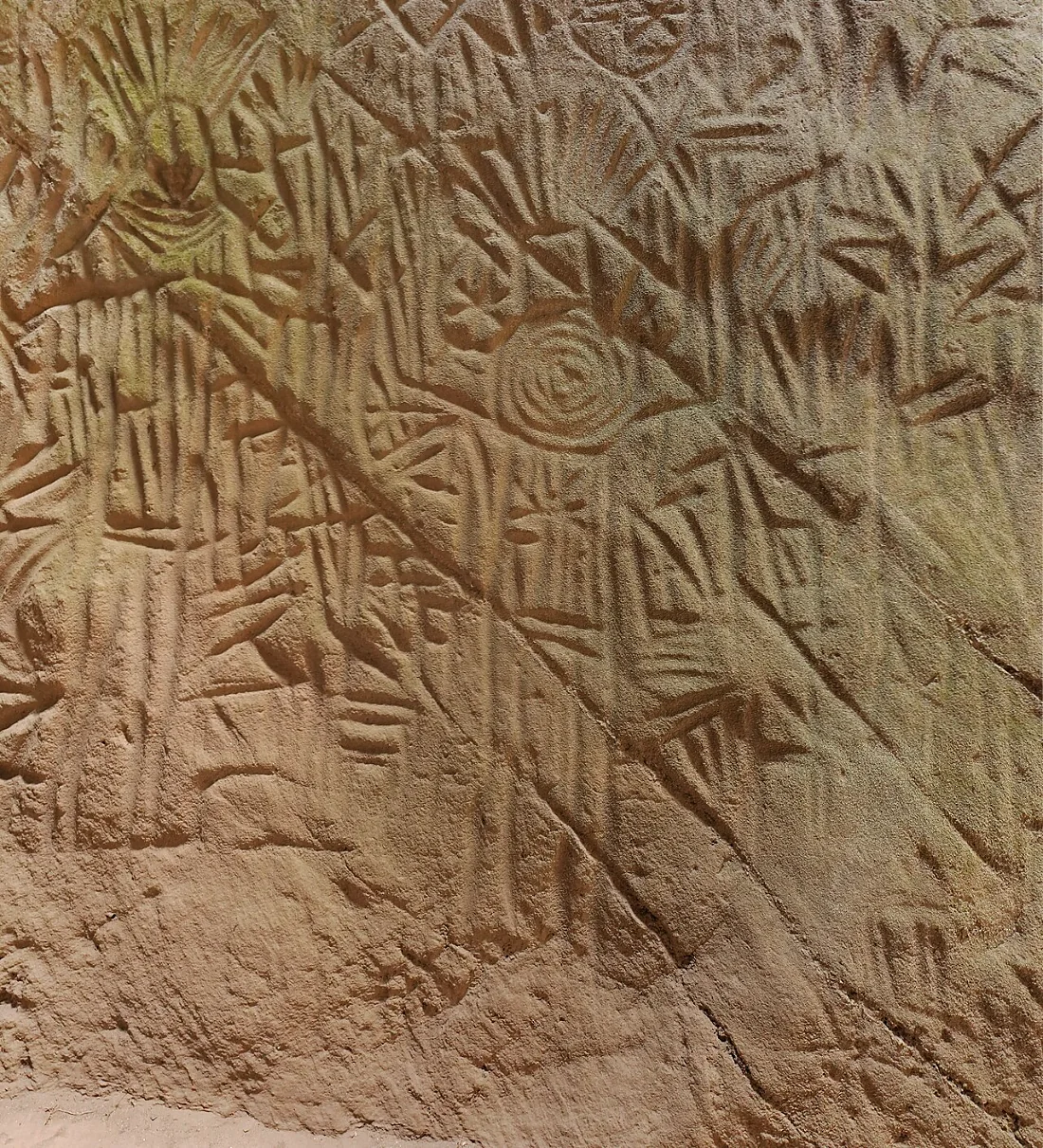
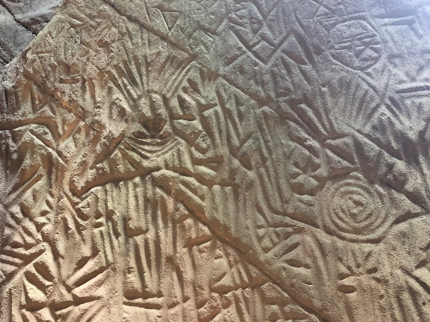
The walls carry a dense tangle of engravings, cut over each other so thickly that, as Fawcett said, it takes long study to make anything of them. Among them are:
- Human figures with headdresses: the most striking motif, figures with fan-like or tufted head ornaments, some with raised arms, some apparently masked;
- Animals, including what may be elephants and deer, and possibly a dog and a wheeled cart;
- Wheels, rosettes and concentric circles, the 'sun' symbols that Fawcett noticed;
- Grids, nets and 'magic squares', and many signs that have no clear meaning;
- A figure holding a cup or jar, which became famous in 2009 (see below).
The inscriptions
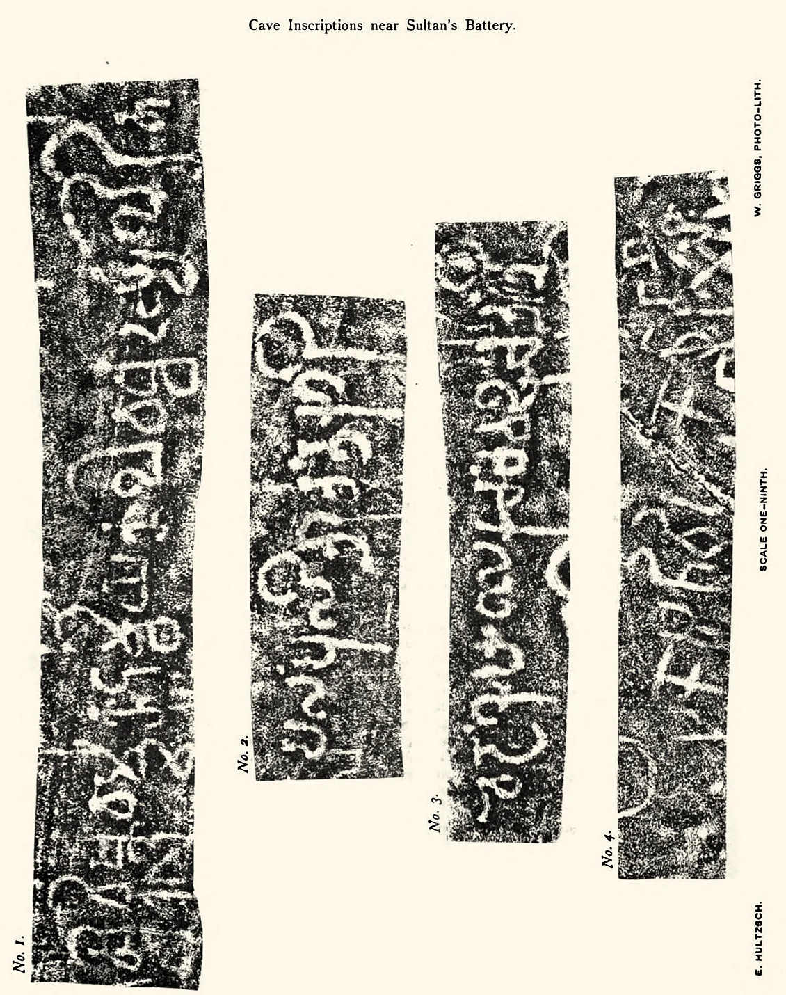
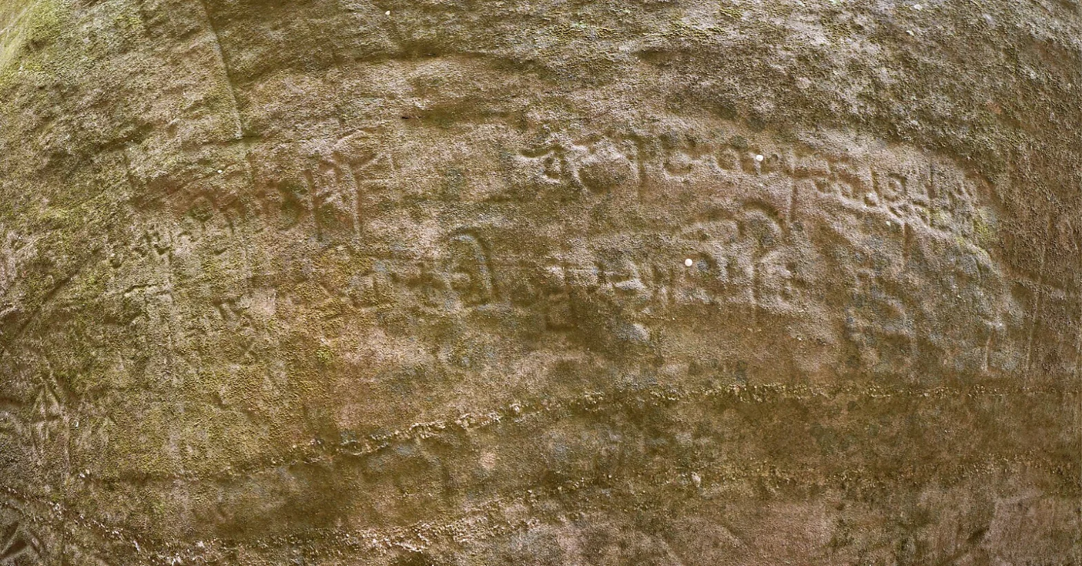
Among the carvings are a handful of short inscriptions, far later than most of the engravings. Fawcett sent ink impressions (estampages) to E. Hultzsch, the government epigraphist, who reported five short inscriptions, four 'in archaic characters'. Hultzsch read the clearest of them as:
Sri-Vishnuvarmmano Kutumbiya-kula-vardhanasya likhitam, 'the writing of the glorious Vishnuvarman, the propagator of the Kutumbiya family'.
He noted that names ending in varman belonged to rulers, so Vishnuvarman 'was probably a chief or king'. Later scholars have often identified him with a Kadamba king of the 5th century CE, from the dynasty that ruled from Banavasi on the Karnataka plateau. Another inscription Hultzsch found unintelligible but 'decidedly archaic'; the remaining ones were read, then and since, in different ways. Scholars now generally regard the oldest of them as written in an early form of the Tamil-Brahmi script, from the early centuries CE, and they have proposed readings of personal names, but there is no single agreed reading.
Our assessment: how old are the carvings?
The Edakkal engravings are often said to be 6,000 or even 8,000 years old. These figures should be treated with caution. Rock engravings are very hard to date directly; no scientific dating of the Edakkal carvings has been published, and the dates quoted come from comparison of styles and from the archaeology of the surrounding region.
The circumstantial evidence points to many periods. Fawcett's deep layer of earth on the floor supports great age. The headdressed human figures and the abundance of geometric signs resemble the art of the Neolithic and Iron Age in South India, and Fawcett himself noted stone circles, Iron Age burial monuments, on the hills around. The inscriptions belong to the first centuries CE and the 5th century. Our reading is that the cleft was a special place over a very long time, from the late Stone Age through the Iron Age to the early historic period, and that people kept returning to add their marks. It is the accumulation of these layers, not a single date, that makes Edakkal remarkable.
Our assessment: an Indus link?
In 2009, the historian M. R. Raghava Varier of the Kerala State Archaeology Department announced that one of the Edakkal figures, a man with a jar-like cup, resembled a well-known sign of the Indus script, and the Indus scholar Iravatham Mahadevan called it a major discovery. The claim attracted great attention, and some went on to describe Edakkal as an Indus site.
A resemblance between two signs is interesting, but it is not proof of a connection. Simple pictograms (a person, a pot) can arise independently in many cultures, and the Indus script itself remains undeciphered. There is no other evidence of Harappan presence in Wayanad. We think the most that can fairly be said is that the sign is a striking parallel that deserves study, and that Edakkal's real importance does not depend on it.
From the Kadambas to Tipu Sultan
For much of its history Wayanad was a frontier country, ruled from the plateau to the east or from the coast to the west. The Kadambas, the Gangas, the Hoysalas and the Vijayanagara empire held it at different times; local chiefs, the Kottayam rajas of north Malabar among them, governed it in practice.
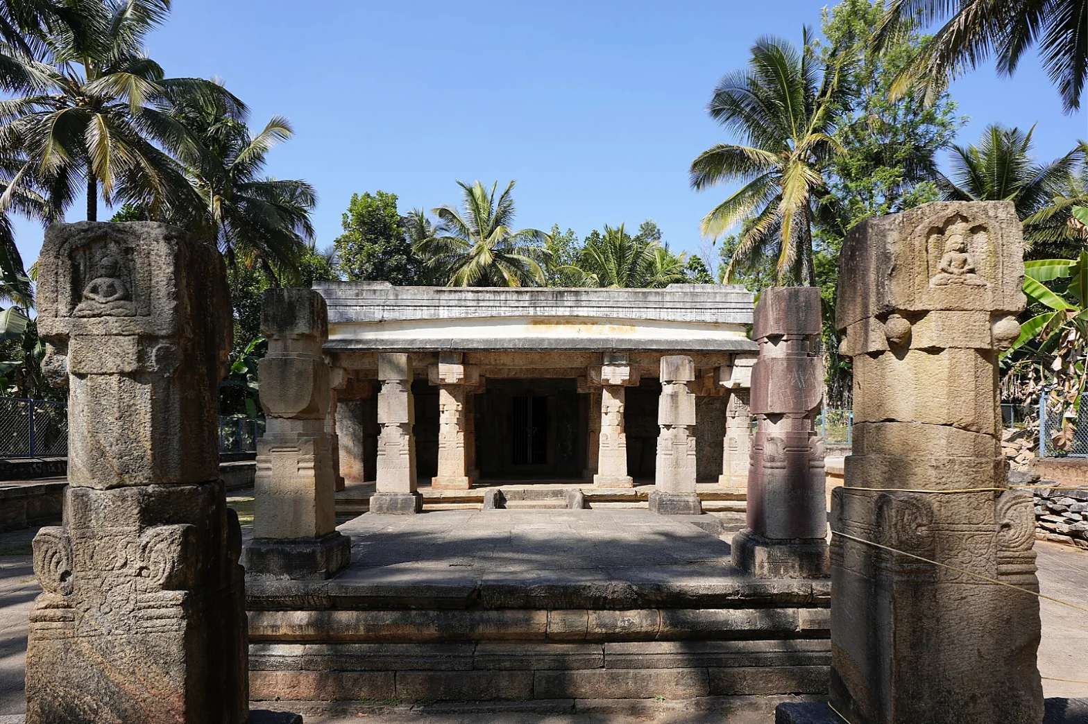
One monument of that long medieval story is the granite Jain temple at Sultan Bathery, believed to date from about the 13th century, when Jain traders and farmers from Karnataka had settled in the area: the town was then called Ganapathivattam, and had Jain streets of its own. In the 18th century the armies of Hyder Ali and Tipu Sultan of Mysore came through Wayanad on their way to Malabar, and the temple is said to have been used by Tipu as an ammunition store. The British called the place 'Sultan's Battery', which became the town's name, Sultan Bathery.
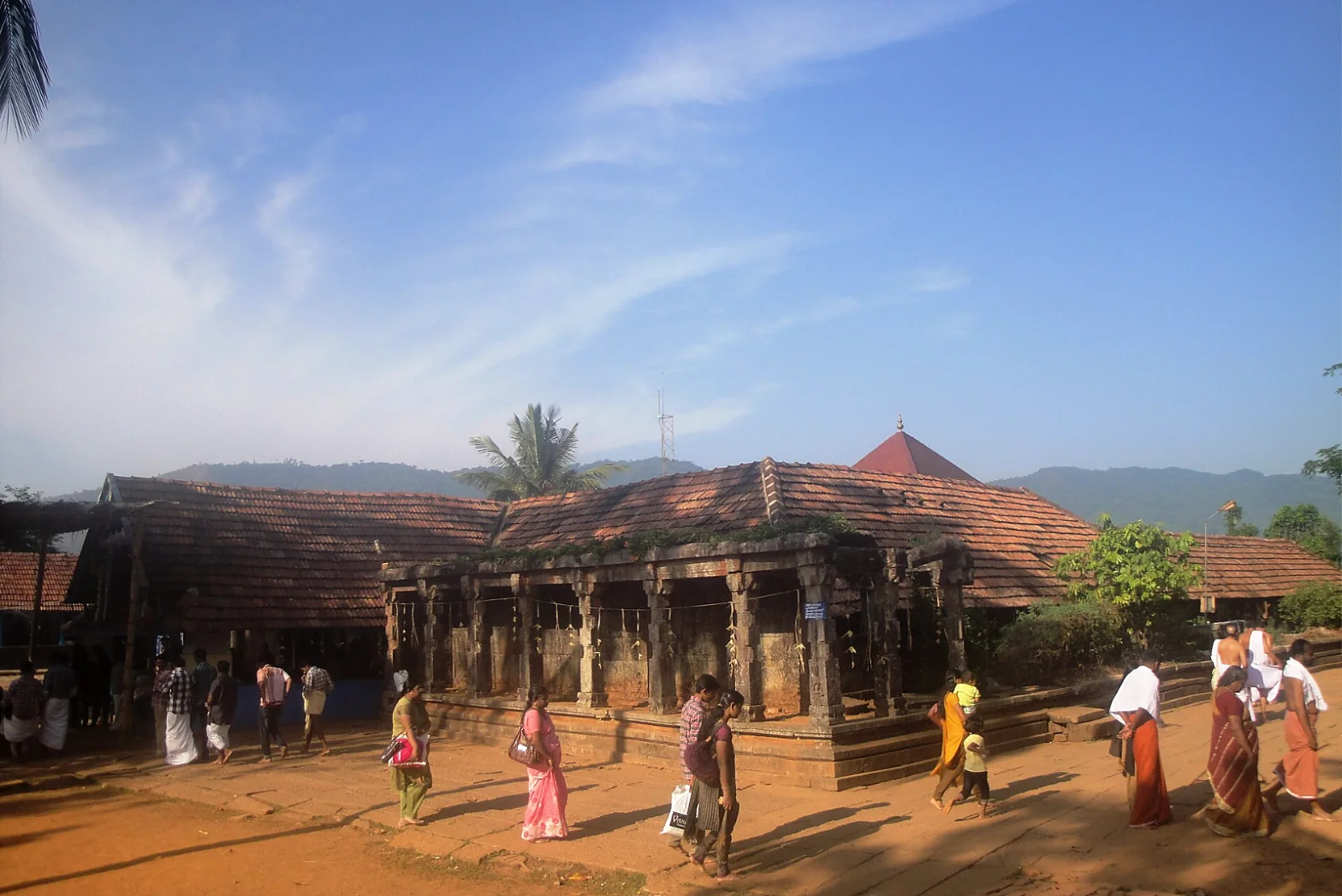
At Thirunelli, deep in the forest at the foot of the Brahmagiri hills, stands one of the oldest temples of Kerala, dedicated to Vishnu and known as 'the Kashi of the south' for the rites for ancestors performed in the stream Papanasini. Its copper-plate grant of the Chera king Bhaskara Ravivarman, published by Hultzsch in 1891 from the plates then kept at Mananthavady, shows that the temple was already an important institution around the 11th century.
Pazhassi Raja: the lion of the forest
Wayanad's most famous historical figure is Kerala Varma Pazhassi Raja (1753–1805) of the Kottayam royal house of north Malabar, remembered as Kerala Simham, 'the Lion of Kerala'. He first resisted the Mysore armies of Hyder Ali and Tipu Sultan, at times in alliance with the East India Company. But when the Company, having taken Malabar from Tipu in 1792, imposed its own revenue settlement and claimed Wayanad, Pazhassi turned against the British. The war that followed, which the British called the Cotiote (Kottayam) War, lasted with interruptions from 1793 to 1805.
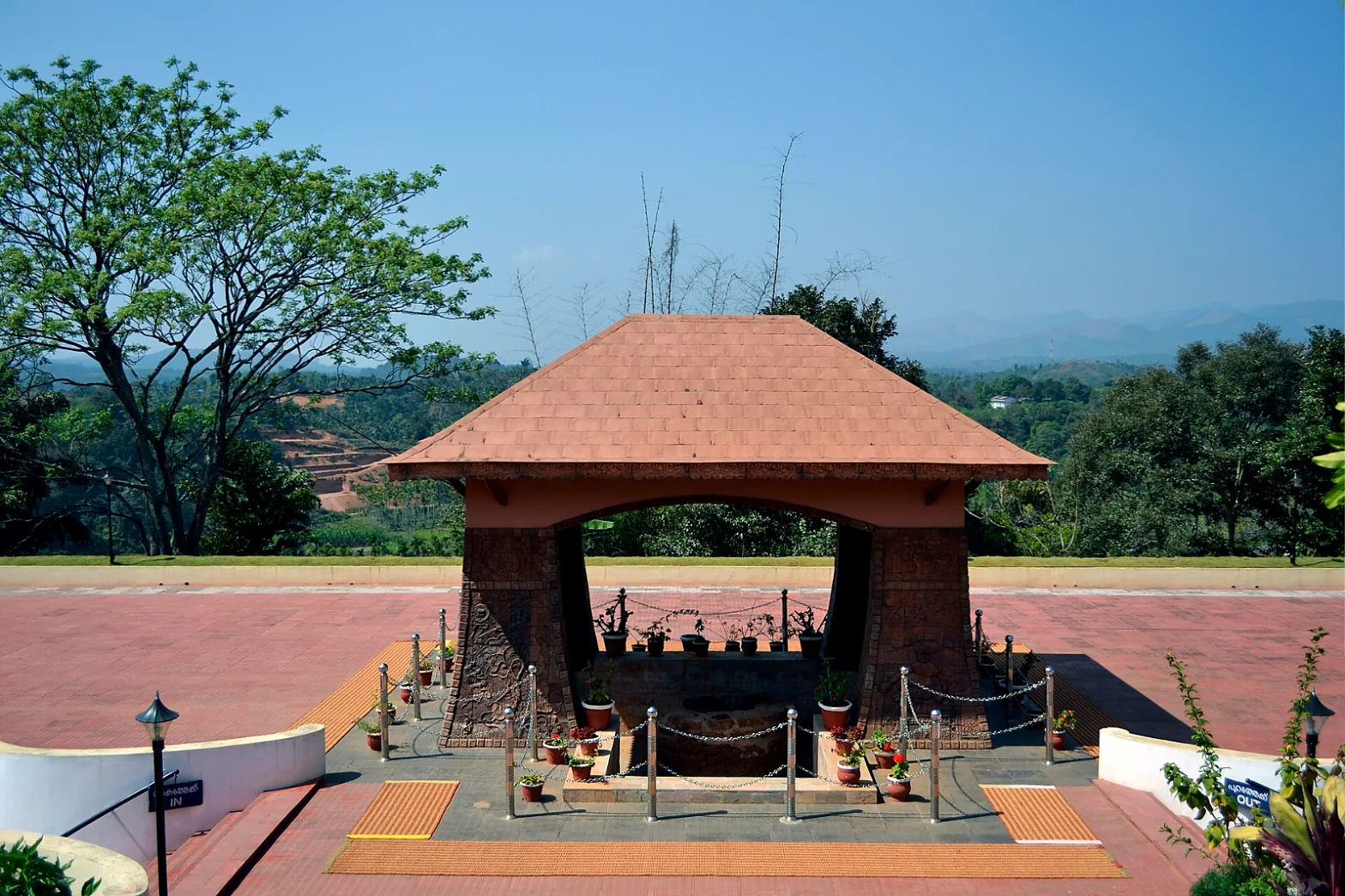
Pazhassi fought from the forests of Wayanad and the Purali hills, with Nair and Mappila fighters and, above all, the Kurichiya and Kuruma archers of the plateau, led by commanders such as Thalakkal Chandu. Among the officers sent against him was the young Arthur Wellesley, the future Duke of Wellington, who commanded in Mysore and Malabar at the time. Pazhassi was finally killed on 30 November 1805 in a clash at Mavila Thodu, a stream near Pulpally, by a force under the sub-collector Thomas Hervey Baber. Accounts of his last moments differ, and a popular tradition says he swallowed a diamond ring rather than be taken alive. Baber had his body carried on his own palanquin to Mananthavady, where he was cremated with honours, and he wrote that the Raja was held in respect by all classes of people even after his death. His tomb at Mananthavady is a memorial today.
Our assessment: Pazhassi and the people of the hills
Pazhassi Raja is often presented as a lone royal hero, and Wellesley himself thought the revolt was essentially one man's. We think that underestimates his allies. A war in the Wayanad forests could not have lasted twelve years without the Kurichiya and Kuruma communities, whose archers, knowledge of the forest and loyalty sustained it; their leaders, like Thalakkal Chandu, were captured and executed too. The story of Wayanad's resistance is as much theirs as the Raja's. It is fitting, then, that the long human story of this plateau begins on the walls of Edakkal, made, as far as anyone can tell, by the ancestors of the hill peoples who still live around it.
Wayanad today
Coffee and pepper estates, laid out from the 19th century onwards, settlers from Travancore who came in great numbers in the 20th, wildlife sanctuaries and, more recently, tourism have transformed the plateau. Wayanad also knows sorrow: on 30 July 2024, landslides at Mundakkai and Chooralmala after extreme rain killed some 298 people, and 32 more who were never found were later declared dead, one of the worst disasters in Kerala's history. The tourist places of Wayanad reopened in stages afterwards, and responsible visitors are an important part of its recovery.
Edakkal itself is fragile. Heavy rain in 2018 washed water and debris into the cave, and since then entry has been limited to 1,920 visitors a day. Quarrying on the hills around has long been a concern for the safety of the rock.
Visiting Edakkal
- Getting there: from Sultan Bathery or Kalpetta by road to the foot of Ambukuthi Mala near Ambalavayal; a jeep shuttle runs part of the way, then a steep walk of about 1 km and iron steps lead to the cave.
- Timings: as reported in January 2026, entry from 8.30 am, no entry to the hill after 4 pm, and closed on Mondays. The daily limit is often reached by afternoon, so go early.
- Tickets (January 2026): Indian visitors ₹50, foreign visitors ₹60, still camera ₹25, video camera ₹100, jeep shuttle ₹70. Check the official Wayanad tourism site before you go.
- Respect: the premises are plastic-free. Never touch, chalk or scratch the engravings: they have survived thousands of years and can be damaged in minutes.
- Fitness: the climb is steep; wear good shoes and carry water.
- Nearby: the Jain temple at Sultan Bathery, the Thirunelli temple, Pazhassi Raja's tomb at Mananthavady, and the wildlife of Muthanga and Tholpetty.
Read also: Kozhikode and the Zamorins · Thalassery · Kannur · Bekal Fort and Tipu Sultan · Theyyam
See it for yourself, with a local driver who knows these roads.
Book a Munnar Jeep SafariSources & further reading
- F. Fawcett, Notes on the rock carvings in the Edakal Cave, Wynaad, The Indian Antiquary vol. 30 (1901), via Wikimedia Commons
- Wikipedia: Edakkal Caves
- Sahapedia: Edakkal Caves
- Onmanorama (3 January 2026): Daily limit and rules at Edakkal caves
- Wikipedia: Pazhassi Raja
- Kerala Tourism: Bathery Jain Temple
- Kerala Tourism: Thirunelli Temple
- E. Hultzsch, The Tirunelli copper-plate grant, The Indian Antiquary vol. 20 (1891)
- Down To Earth (2026): Two years after the Mundakkai-Chooralmala catastrophe
Figures are from the sources listed and were checked in October 2026. Park timings and road conditions change, so please confirm before you travel.