
Rameswaram and Dhanushkodi: The Temple, the Bridge and the Ghost Town
The longest temple corridors in India, a sea bridge opened in 1914, a port town swept away in a single night in 1964, and the chain of shoals that legend calls Rama's bridge. The story of India's south-eastern tip, with old photographs, satellite images and our own assessments.
At the south-eastern tip of India, a long, low island of sand and coral reaches out towards Sri Lanka. On it stands Rameswaram, one of the holiest towns in India, where tradition says Rama worshipped Shiva before crossing to Lanka. Beyond it, at the very end of the land, lie the ruins of Dhanushkodi, a busy port town destroyed in a single night by the cyclone of December 1964. And beyond Dhanushkodi, a chain of shoals runs across the sea to Sri Lanka: Rama Setu, or Adam's Bridge.
This article tells the story of the island, its temple, its bridges and its ghost town, with old photographs and engravings, satellite images, and our own reading of the evidence where legend and history meet.
At a glance
- Where: Pamban island, Ramanathapuram district, Tamil Nadu; linked to the mainland at Mandapam by rail and road bridges.
- Temple: Ramanathaswamy, one of the twelve Jyotirlingas and one of the four Char Dham pilgrimage sites.
- Bridges: Pamban rail bridge (1914, replaced by a new vertical-lift bridge in 2025); road bridge (1988).
- Dhanushkodi: destroyed by the cyclone of 22–23 December 1964.
- Rama Setu / Adam's Bridge: a chain of limestone shoals between Dhanushkodi and Talaimannar in Sri Lanka.
The legend
In the Ramayana tradition, Rama, having killed Ravana, wished to atone for slaying a Brahmin. He was told to worship Shiva, and sent Hanuman to bring a linga from Mount Kailash. When Hanuman was delayed, Sita made a linga of sand, and Rama worshipped it at the auspicious hour. That is the Ramalingam, the main deity of the temple. When Hanuman arrived with his linga, the Vishwalingam, Rama ordered that it should be worshipped first, a custom still followed. Pilgrims traditionally bathe in the sea at Agni Theertham and then in the 22 sacred wells and tanks (theerthams) inside the temple, said to represent the arrows in Rama's quiver.
The Ramanathaswamy temple
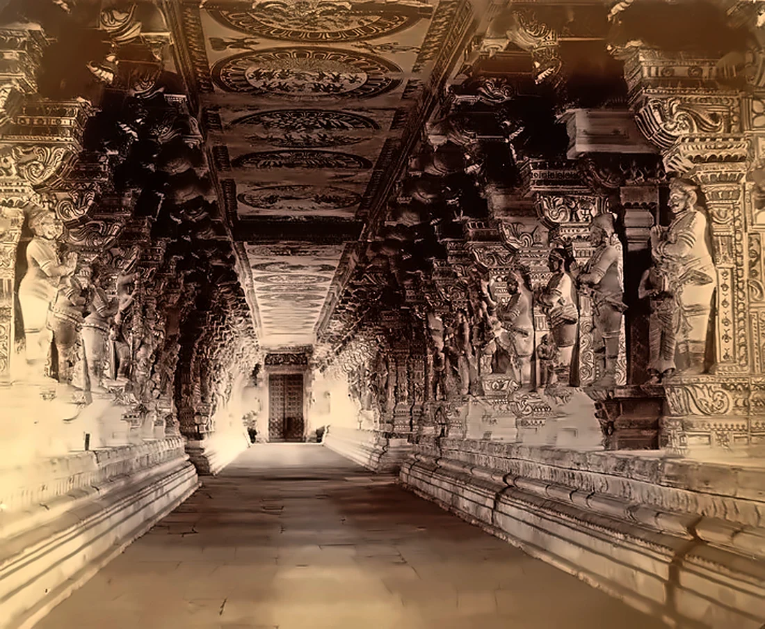
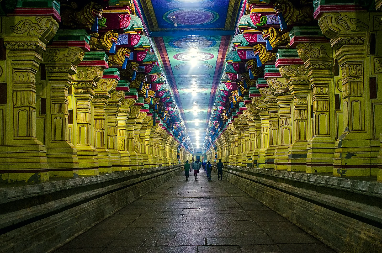
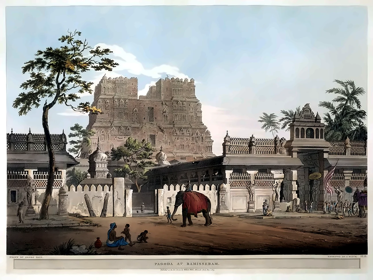
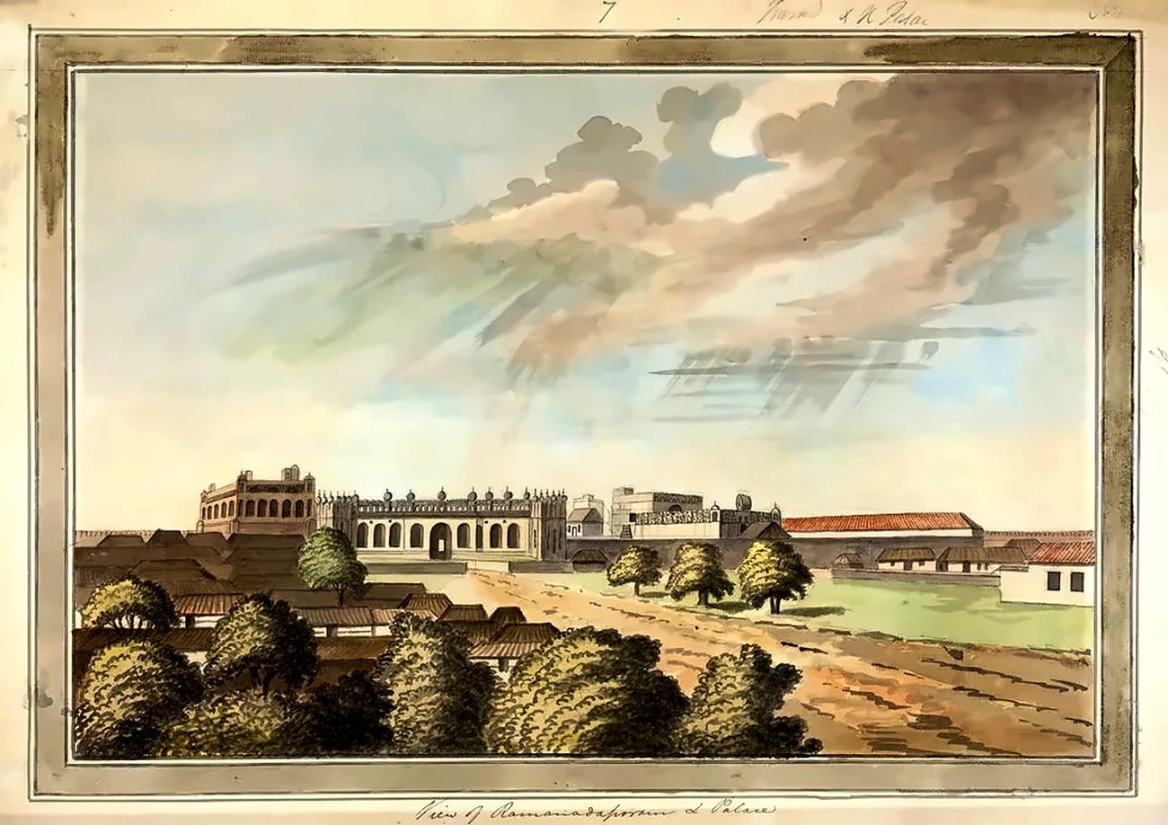
The shrine began, it is said, as a simple sanctuary, and grew over many centuries. The Pandya kings expanded it in the 12th century; kings of Sri Lanka, including Parakramabahu I and Nissanka Malla, and later the Aryachakravarti kings of Jaffna, gave gifts and stone for the sanctum. But the temple we see today is largely the work of the Sethupathis, the hereditary chiefs of Ramanathapuram (Ramnad), who called themselves "guardians of the bridge" (Sethu-pathi) and protected the pilgrim route to the island. They built the great gopurams and, above all, the corridors. The third corridor, completed in the late 18th century under Muthuramalinga Sethupathi, gives the temple the longest pillared corridors of any Hindu temple: the outer corridors run about 400 feet east–west and 640 feet north–south, with some 1,200 carved pillars on raised platforms, and the total length of the corridors is close to 4,000 feet.
Rama Setu, or Adam's Bridge
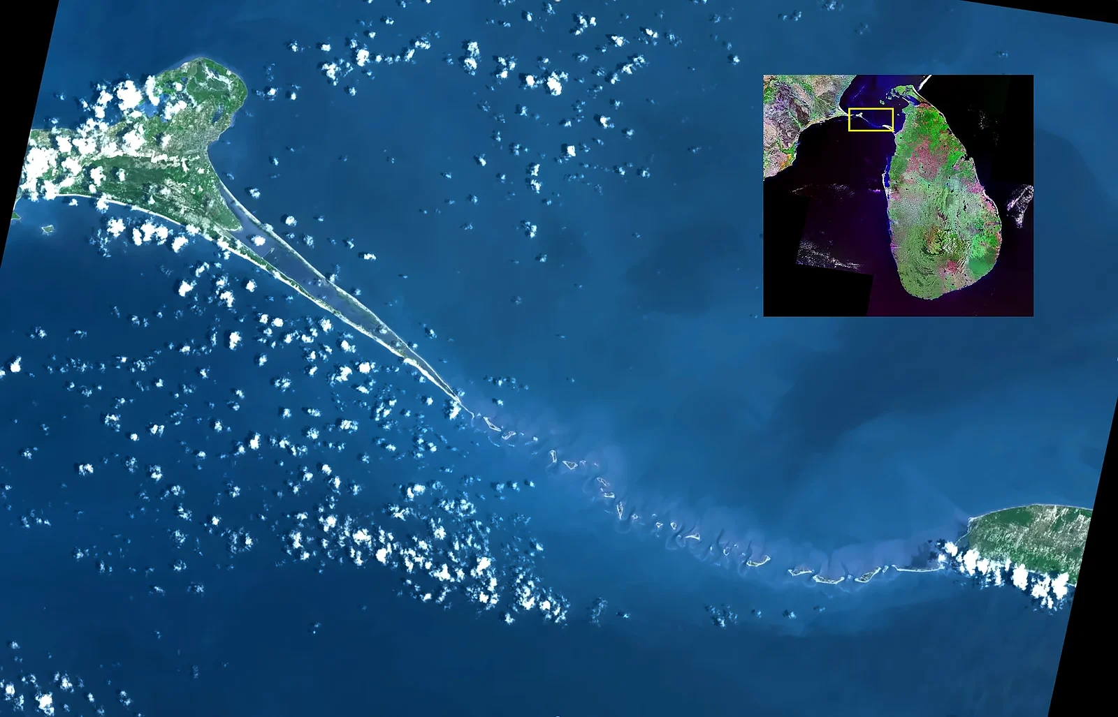
Between Dhanushkodi and Talaimannar on Mannar island in Sri Lanka, a line of sandbanks and limestone shoals stretches across the sea for about 30 km. Hindu tradition identifies it with the Setu, the bridge that Rama's army of monkeys and bears built to cross to Lanka. Islamic tradition, through which it reached European maps, named it Adam's Bridge, by which Adam crossed from Adam's Peak in Sri Lanka after his expulsion from paradise. Old records, including temple tradition, say that it could be walked across until a storm in the 15th century (often given as 1480) breached it; this is plausible but not proven. Today the water over most of it is only a metre or two deep, and large ships cannot pass through, which is why ships between India's west and east coasts must sail around Sri Lanka.
Our assessment: is Rama Setu natural or man-made?
This is one of India's most debated questions, and it became political during the controversy over the Sethusamudram shipping canal project in the 2000s. Our reading of the evidence:
- Geological studies, including a 2024 study by ISRO scientists using NASA's ICESat-2 satellite, show a continuous submerged ridge about 29 km long, made of sand, coral and limestone formed over very long periods. It is best explained as the remains of a natural land connection between India and Sri Lanka, exposed and submerged again and again as sea levels rose and fell.
- India and Sri Lanka were joined by dry land during the last Ice Age, and the link was finally drowned only a few thousand years ago.
- No scientific study has shown that the ridge was built by human hands.
Our view: Rama Setu is a natural formation. That does not lessen its meaning for millions of people. It is likely that the very existence of this 'bridge' across the sea, visible from the shore and from the hills of Rameswaram, helped give rise to the epic story, or helped fix the story in this place. Faith and geology tell different kinds of truth about it, and both deserve respect.
The Pamban bridge
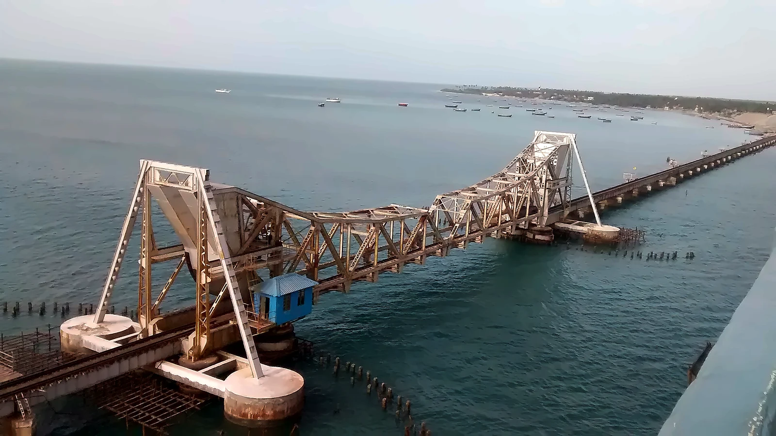
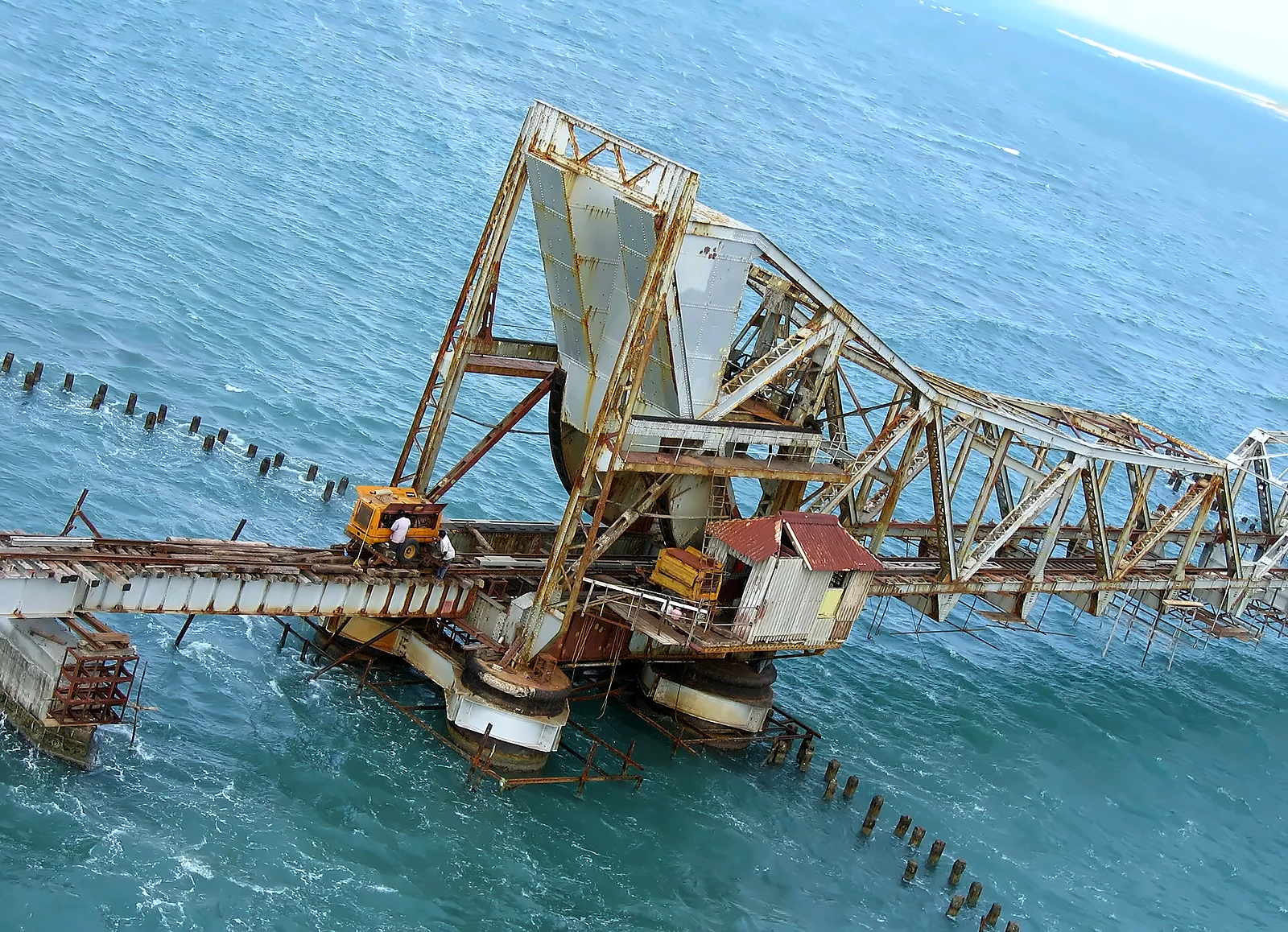
Until the 20th century, pilgrims crossed to the island by boat. In 1914 the South Indian Railway opened the Pamban rail bridge, about 2 km long, India's first sea bridge. Its centre had a double-leaf bascule span (often called the Scherzer span) whose two halves were lifted by hand to let ships pass through the channel. Trains ran across the island to Dhanushkodi, where passengers of the famous Boat Mail from Madras boarded a steamer to Talaimannar in Ceylon and continued by train to Colombo. It was the quickest route between India and Ceylon.
For more than a century the old bridge survived salt, storms and the 1964 cyclone. A road bridge, the Annai Indira Gandhi bridge, was opened alongside it in 1988. Corrosion finally closed the rail bridge in December 2022, and in April 2025 a new bridge was inaugurated beside it, with India's first vertical-lift railway span over the sea.
Dhanushkodi: the night of 22 December 1964
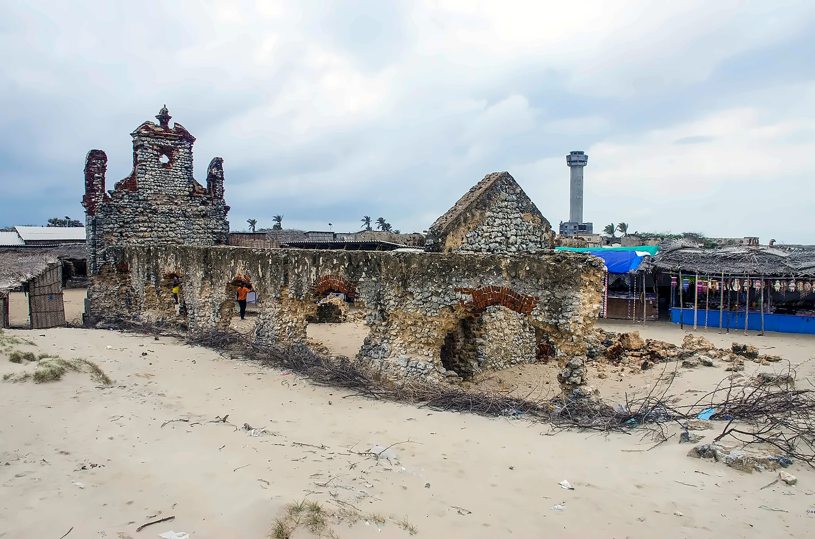
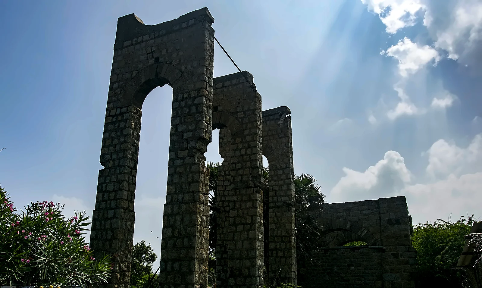
In the first half of the 20th century, Dhanushkodi ("the tip of the bow", from the legend that Rama marked the place for the bridge with the end of his bow) was a thriving small town. It had a railway station, a pier for the Ceylon ferries, customs and post offices, a hospital, schools, churches, temples and rest-houses for pilgrims.
In December 1964 a severe cyclone formed in the south Andaman Sea, crossed northern Ceylon on 22 December and entered the Palk Strait. Late that night it struck Dhanushkodi with winds estimated at over 250 km/h and a storm surge several metres high. Just before midnight, the Pamban–Dhanushkodi passenger train was a few hundred metres from Dhanushkodi station when the wave struck. It was swept into the sea with everyone on board, more than a hundred passengers and railway staff. In the town and across the island, well over a thousand people died; figures of about 1,800 are often given. The Pamban bridge was badly damaged. It was restored in about 46 days, an achievement associated with a young railway engineer, E. Sreedharan, later famous as the builder of the Konkan Railway and the Delhi Metro.
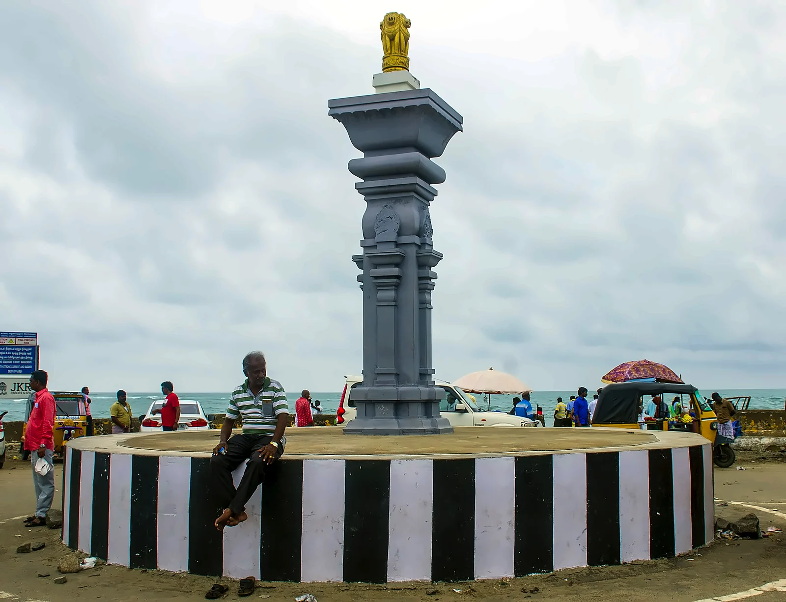
After the cyclone the government declared Dhanushkodi unfit for habitation. The railway line beyond Rameswaram was never rebuilt. Today a few hundred fishing families live among the ruins of the church, the station and the post office, and a road completed in 2017 runs to Arichal Munai, the very tip of the land, where the calm waters of Palk Bay (on the Bay of Bengal side) meet the rougher Gulf of Mannar (on the Indian Ocean side).
Our assessment: could Dhanushkodi have been saved?
In 1964 there were no weather satellites over the Indian Ocean and no system of cyclone warnings reaching small coastal towns. The train went ahead into the storm because the signal had failed and the driver chose to proceed. Today, satellite tracking, warnings and evacuation would almost certainly save most lives in such a storm, as Odisha and Tamil Nadu have shown in recent cyclones. But Dhanushkodi itself was built on a low, narrow spit of sand between two seas, exposed to surges from both sides. Our view: the lives could have been saved with modern warnings; the town, in that position, probably could not.
Two famous sons and visitors
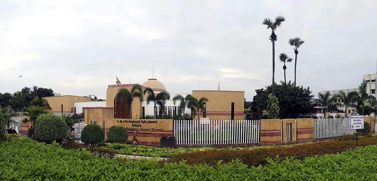
In January 1897, Swami Vivekananda landed at Pamban on his triumphant return from the West, and was welcomed by Bhaskara Sethupathi, the Raja of Ramnad, who had helped fund his journey to the Parliament of Religions in Chicago. Rameswaram is also the birthplace of Dr A. P. J. Abdul Kalam (1931–2015), the boatowner's son who became a missile scientist and the 11th President of India. His family home is now a museum, and a memorial at Pei Karumbu on the island, where he is buried, was opened in 2017.
Visiting
- Getting there: Rameswaram is about 170 km by road from Madurai (the nearest airport) and is linked by train to Chennai and Madurai.
- The temple: the theertham bath is usually done in the early morning; wear clothes that can get wet and carry a change. Phones are not allowed in the sanctum area.
- Dhanushkodi: about 20 km from Rameswaram town; the road to Arichal Munai is open in daylight hours. The sea can be dangerous; do not swim.
- Also see: Kothandaramaswamy temple (said to have survived the 1964 cyclone), Gandhamadhana Parvatham hill, the Kalam house museum and memorial, and the Pamban bridges from the road bridge.
Read also: Madurai and the Meenakshi temple · Hampi and Vijayanagara · Padmanabhaswamy and Thiruvananthapuram
See it for yourself, with a local driver who knows these roads.
Book a Munnar Jeep SafariSources & further reading
- Wikipedia: Ramanathaswamy Temple
- India Water Portal: The story of Dhanushkodi
- Wikipedia: Boat Mail Express
- Deccan Chronicle: the 108-year-old Pamban bridge
- Drishti IAS: New Pamban Bridge
- News report (2024): ISRO sheds light on Adam's Bridge
Figures are from the sources listed and were checked in October 2026. Park timings and road conditions change, so please confirm before you travel.