
Hampi: The Rise and Fall of Vijayanagara, the City of Victory
Hills of giant boulders, the ruins of a capital that travellers compared to Rome, and a city looted for five months after a single battle in 1565. The story of Hampi through the eyes of medieval travellers and the first photographs taken there in 1856, with our own assessments.
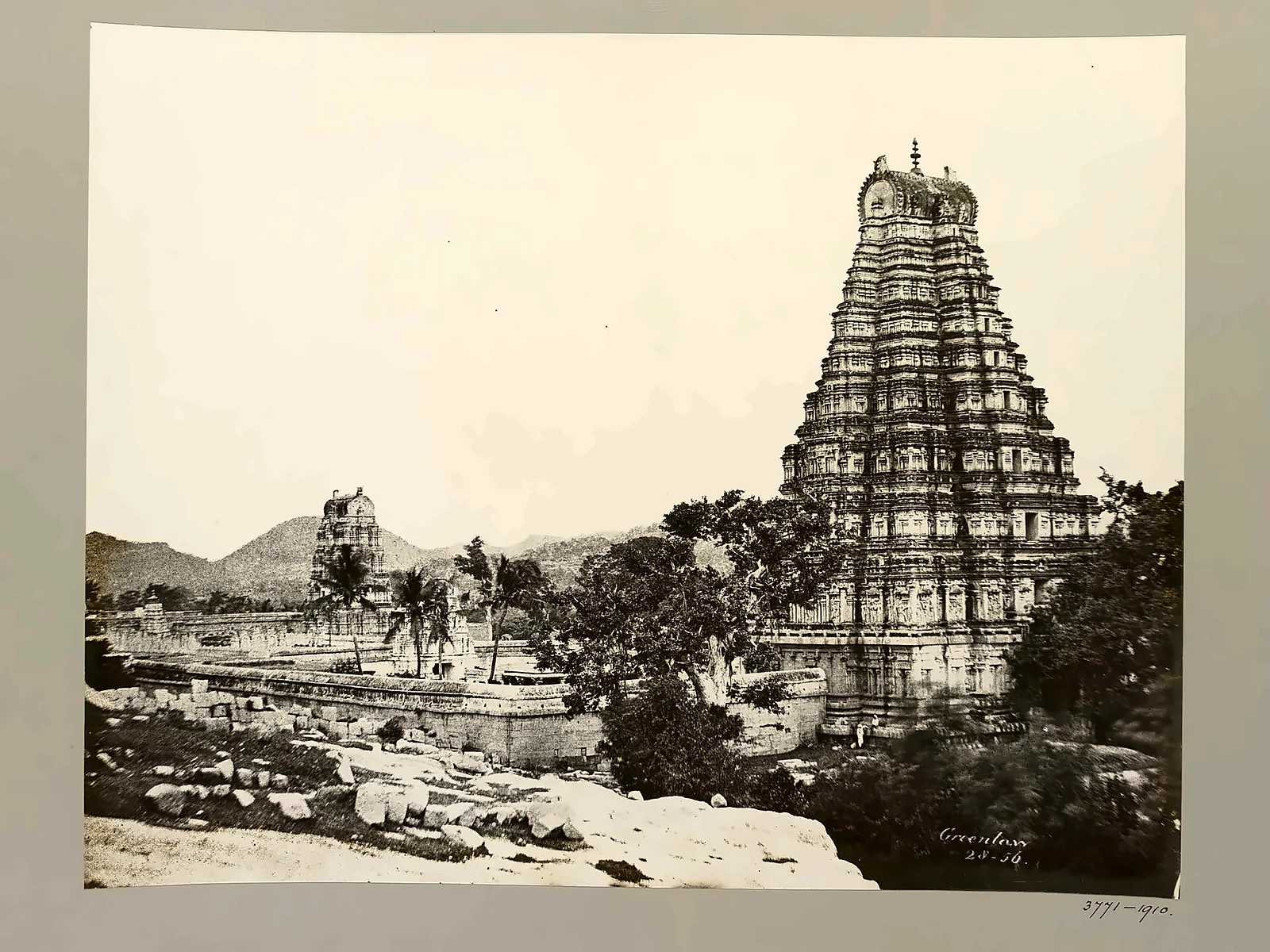
On the south bank of the Tungabhadra river in northern Karnataka lies a landscape unlike any other in India: hills of giant granite boulders, piled as if by giants, and among them the ruins of a vast city. This was Vijayanagara, "the City of Victory", capital of the last great Hindu empire of the south. In the early 16th century it was one of the largest and richest cities in the world. In 1565 it was sacked after a single battle and never lived in again. The village at its heart, Hampi, has given its name to the whole site.
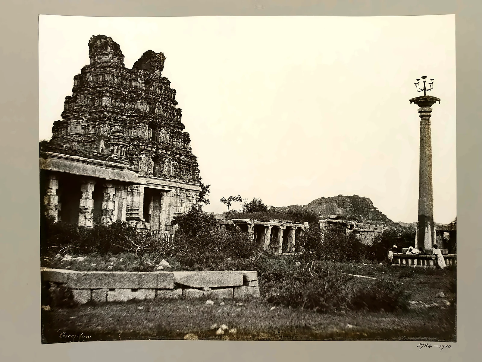
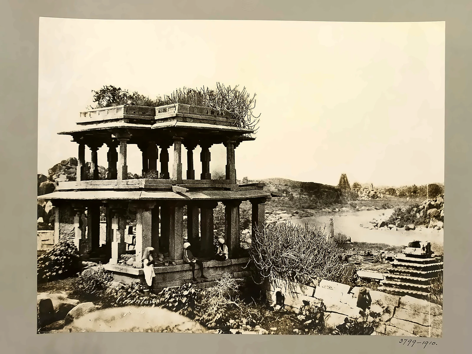
This article tells Hampi's story through the eyes of the foreign travellers who saw it at its height, and through the earliest photographs of its ruins, taken by Alexander Greenlaw in 1856. As always, our own assessments are clearly marked.
At a glance
- Where: Vijayanagara district (formerly Bellary), Karnataka, about 13 km from Hosapete (Hospet).
- Empire: Vijayanagara, about 1336–1646; the city was capital until 1565.
- Greatest king: Krishnadevaraya (reigned 1509–1529).
- Fall: Battle of Talikota, 23 January 1565; the city was looted for about five months and abandoned.
- Status: UNESCO World Heritage Site since 1986 (on the "in danger" list 1999–2006); some 1,600 surviving structures.
Before the empire: Pampa and Kishkindha
The name Hampi comes from Pampa, the old name of the Tungabhadra and of the goddess Pampa, consort of Shiva as Virupaksha, who has been worshipped here since long before the empire. Local tradition identifies the area with Kishkindha, the monkey kingdom of the Ramayana: Anjanadri hill across the river is revered as the birthplace of Hanuman, and Matanga hill, Rishyamuka and Pampa Sarovar all carry names from the epic. The Virupaksha temple was already an important shrine centuries before the city was built around it.
The rise of Vijayanagara
In the early 14th century the armies of the Delhi Sultanate swept through the Deccan, destroying the old kingdoms. Out of this chaos, around 1336, two brothers, Harihara and Bukka, sons of Sangama, founded a new kingdom on the Tungabhadra. Tradition says they were guided by the sage Vidyaranya of Sringeri. Their capital grew into Vijayanagara, and their Sangama dynasty was followed by the Saluva, Tuluva and Aravidu dynasties. For two centuries the empire held the south against the Bahmani sultanate and, after its break-up, the five Deccan sultanates to the north.
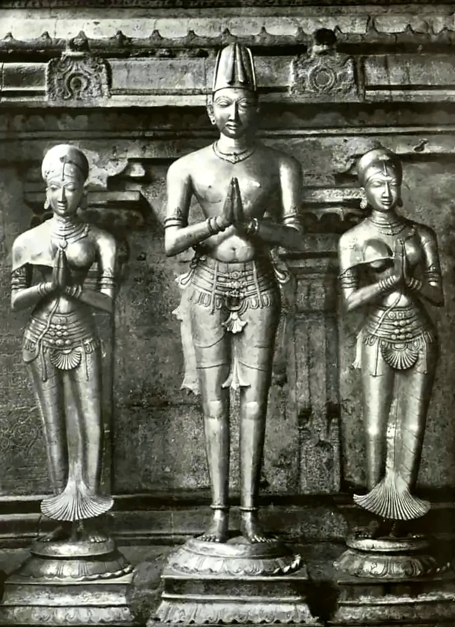
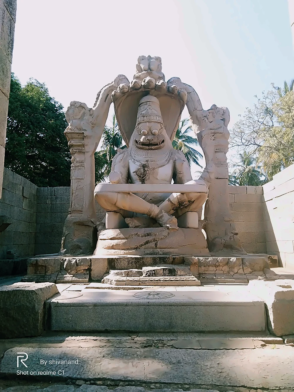
Its golden age came under Krishnadevaraya of the Tuluva dynasty (1509–1529), a successful general, a poet in Telugu and Sanskrit, and a great builder. He added the Krishna temple, the Hazara Rama reliefs and much of the Vitthala temple, and in 1528 commissioned the giant monolithic Narasimha. Bronze portraits of him and his two queens, which he gave to the Tirumala temple in 1518, show how he wished to be remembered: as a devotee standing with joined hands before his god.
The city through foreign eyes
Because no Vijayanagara chronicle of the city survives in such detail, much of what we know of daily life comes from foreign visitors:
- The Italian Niccolò de' Conti (about 1420) described a city sixty miles in circumference, enclosed by walls running up into the hills.
- The Persian ambassador Abdur Razzaq (1443) wrote that the eye had never seen a place like it, describing seven concentric lines of fortification, bazaars full of jewels and the king's great festival.
- The Portuguese horse-trader Domingo Paes (around 1520) thought the city as large as Rome and very beautiful, and described the Mahanavami festival, the king's palace, the army and the markets in remarkable detail.
- His countryman Fernão Nunes (around 1535) wrote a chronicle of the kings, including Krishnadevaraya's wars.
The accounts of Paes and Nunes lay forgotten in Lisbon until the British historian Robert Sewell translated them in A Forgotten Empire (1900), the book that introduced Vijayanagara to the modern world.
Our assessment: how big was Vijayanagara?
Paes compared it to Rome, and travellers spoke of hundreds of thousands of people. Modern archaeologists, working from the extent of the walls and settlement remains, generally estimate a population of a few hundred thousand at its peak, which would make it one of the largest cities in the world in the early 16th century, comparable to Beijing or Paris. Our view: the travellers exaggerated some details, as travellers do, but the scale of the ruins, spread over some 25 square kilometres within the fortified core, shows that their wonder was well founded.
Temples of the sacred centre
The Virupaksha temple, near the river, is the only great temple still in worship. Its eastern gopura, about 50 metres high, was rebuilt and enlarged in the Vijayanagara period. Every year the temple chariot is drawn along the long colonnaded Hampi bazaar in front of it.
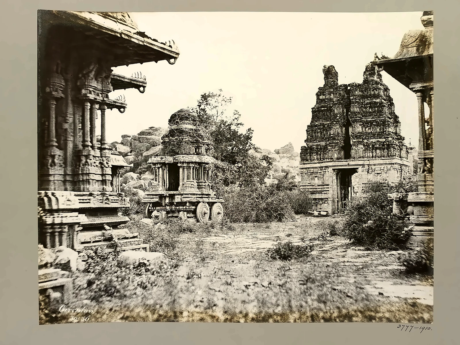
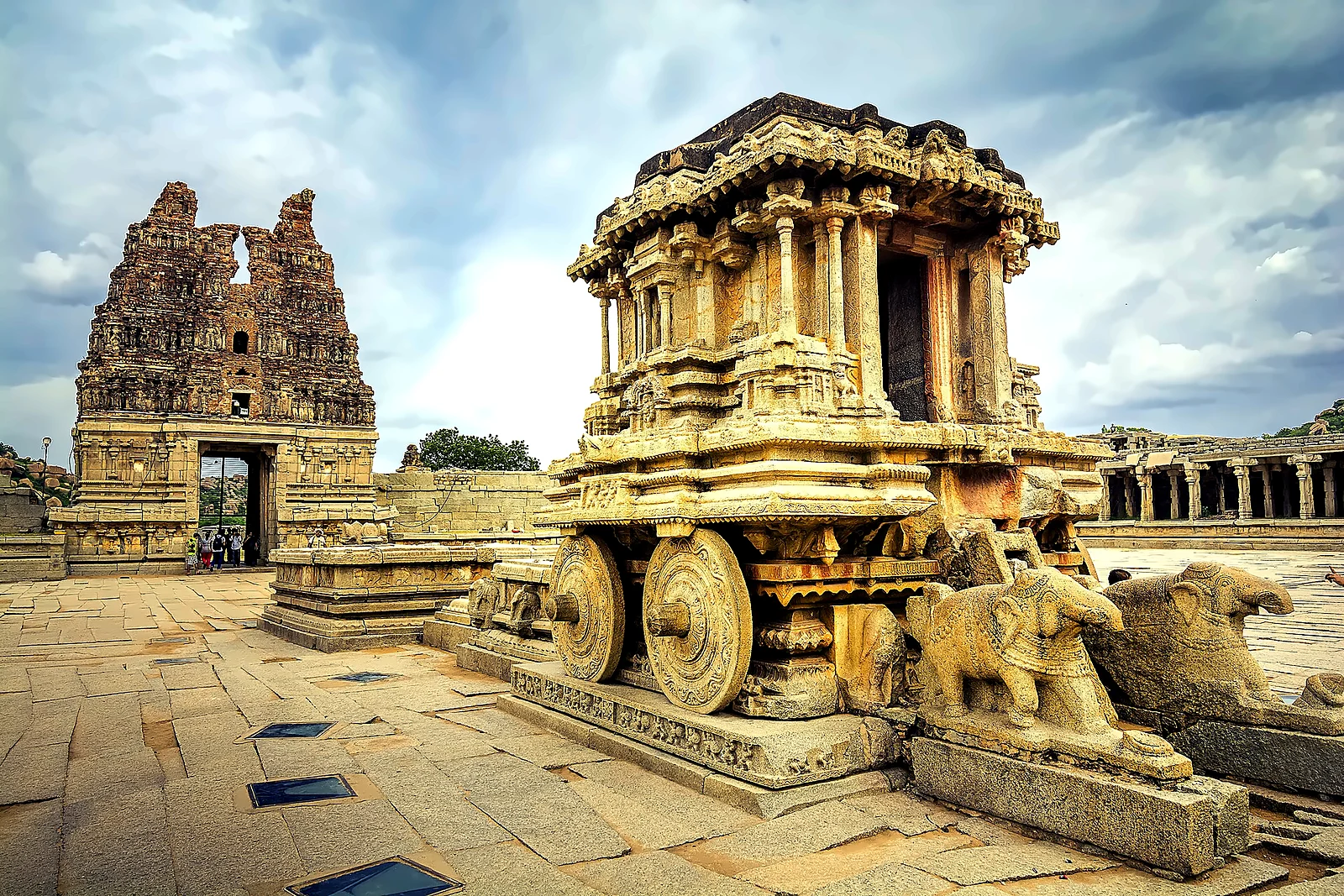
The Vitthala temple, dedicated to Vishnu as Vitthala, is the finest of all. Its pillared halls are carved in astonishing detail; some of its slender granite columns ring with musical notes when tapped (the "musical pillars", which visitors are no longer allowed to touch). In its courtyard stands the famous stone chariot, in fact a shrine to Garuda, Vishnu's eagle, built in the form of a temple car, with wheels that once turned. It is printed on India's fifty-rupee note.
The royal centre
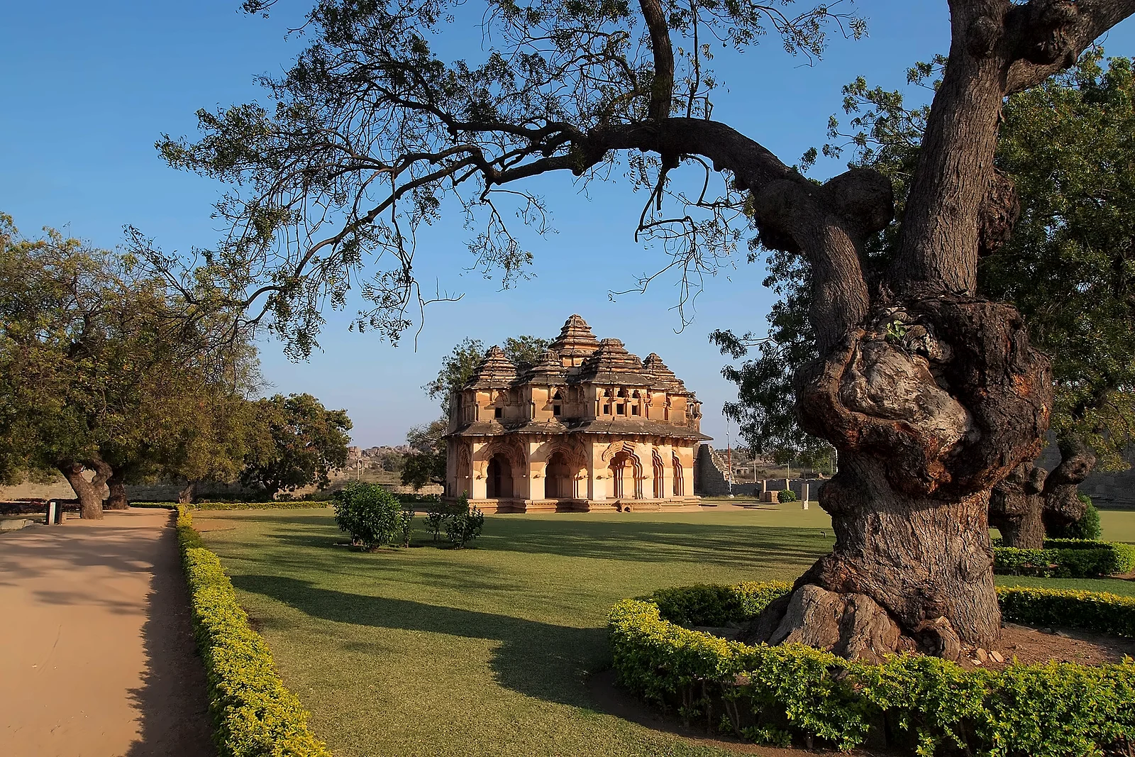
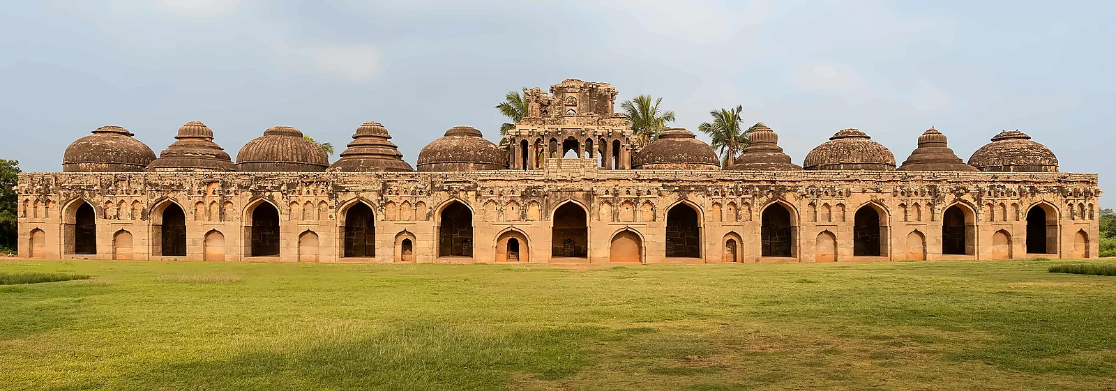
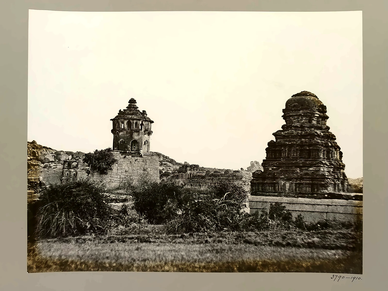
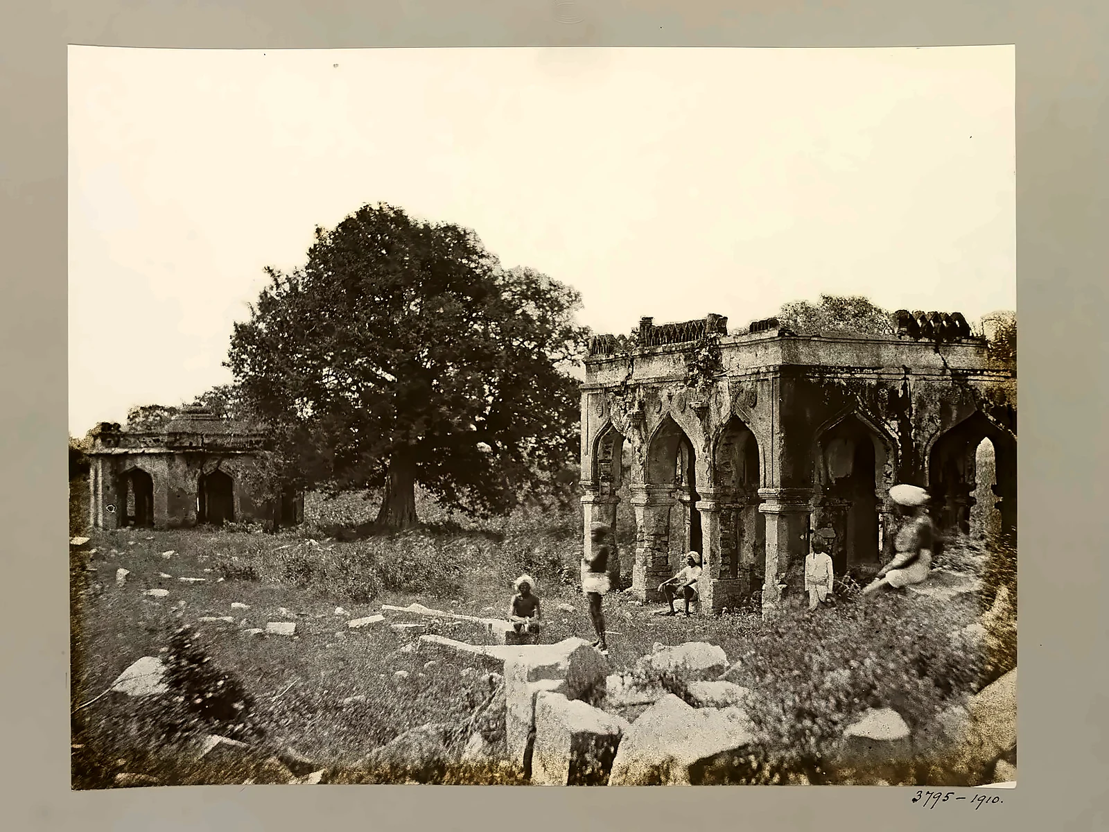
The kings lived in a separate walled enclosure to the south. Here are the great stepped platform of the Mahanavami Dibba, from which the king watched the nine-day festival; the Hazara Rama temple, the royal chapel, whose walls are covered with reliefs of the Ramayana and of processions of horses, elephants and dancers; the stepped tank; the Queen's Bath; and, in the women's enclosure (the zenana), the Lotus Mahal, a graceful pavilion whose arches mix Hindu and Islamic styles. Nearby are the Elephant Stables, a row of eleven domed chambers for the royal elephants.
Our assessment: the Islamic arches of a Hindu capital
Visitors are often surprised to find domes and pointed arches in the capital of a Hindu empire that fought the sultanates for two centuries. We read them as a sign of how connected the Deccan really was. Vijayanagara's kings recruited Muslim cavalry and archers, traded horses with Arab and Persian merchants, and borrowed the fashionable courtly architecture of their rivals for their palaces and pavilions, while keeping the temple tradition for their gods. A Vijayanagara king was even called 'Sultan among Hindu kings'. Politics, war and culture across the Deccan did not run on simple religious lines.
The river
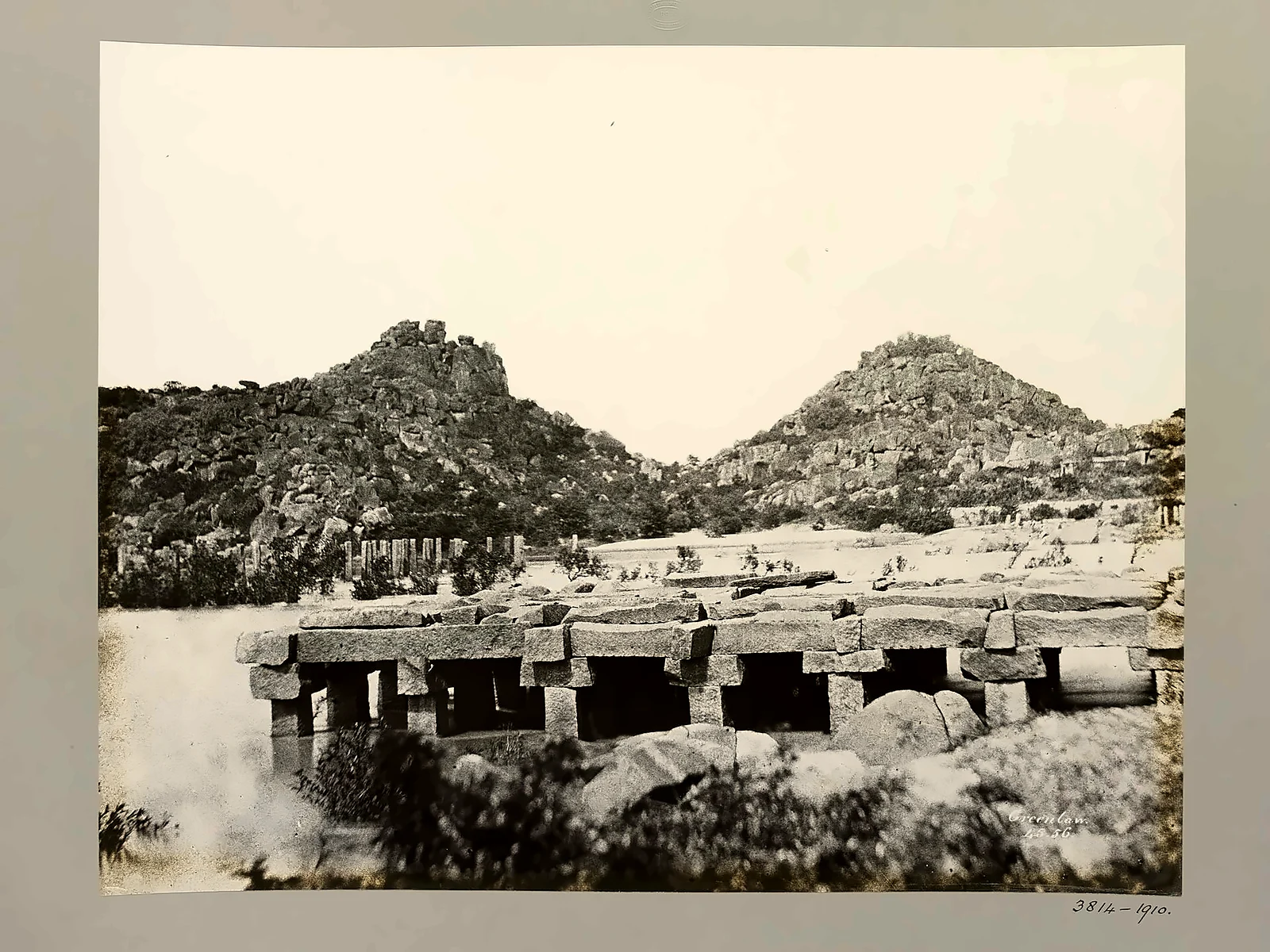
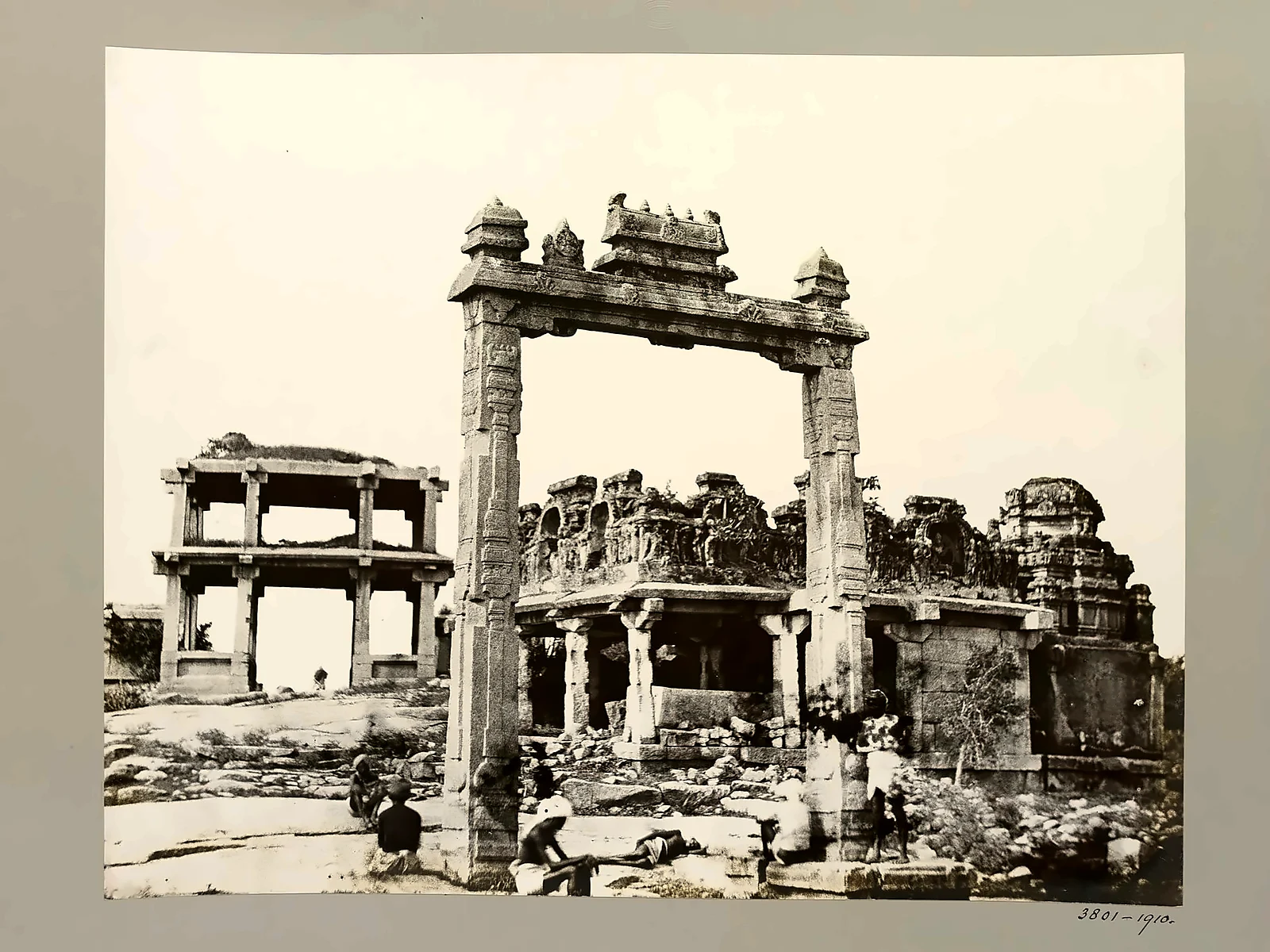
The Tungabhadra made the city possible. Canals and aqueducts, some still in use, carried its water to fields and tanks. Along its banks stand shrines, bathing ghats and the King's Balance (tula), a stone gateway from which, on festival days, the king was weighed against gold, grain or jewels that were then given away. Ruins of an old stone bridge still stand in the river near the Vitthala temple.
Talikota and the sack of the city
After Krishnadevaraya's death, real power passed to the regent Rama Raya, who played the Deccan sultanates off against one another. In the end they united against him. On 23 January 1565, at a battle usually named after Talikota (fought near the villages of Rakkasagi and Tangadagi, on the Krishna river), the combined armies of Bijapur, Ahmadnagar, Golconda and Bidar defeated the Vijayanagara army. Rama Raya, then about eighty, was captured and beheaded. The army broke and fled.
The capital was left almost undefended. For about five months it was plundered and burned. The court withdrew to Penukonda, and the empire survived for several more decades under the Aravidu dynasty, but Vijayanagara itself was never lived in again.
Our assessment: why did a great empire fall in a single afternoon?
Contemporary accounts suggest that the battle was going well for Vijayanagara until two Muslim commanders in Rama Raya's army changed sides at a critical moment, and Rama Raya was captured. That was the immediate cause. The deeper causes, in our view, were three:
- Overconfidence and diplomacy that backfired: Rama Raya's habit of interfering in the sultanates' quarrels and humiliating them finally united enemies who usually fought each other.
- Military technology: the sultanates had better artillery and mounted archers, and Vijayanagara depended heavily on hired troops.
- Centralisation: with the old king a figurehead and all power held by Rama Raya, his death left no one to rally the army or defend the capital.
It is sometimes told as a simple Hindu–Muslim war, but both armies included soldiers of both faiths, and both sides had allied with the other in earlier wars. The destruction of the city, carried out over months, also involved local plunderers. The tragedy of Hampi was political as much as religious.
Rediscovery
For two centuries the ruins were left to villagers, pilgrims and the boulders. In about 1800 Colin Mackenzie, later the first Surveyor General of India, surveyed them and had drawings made. In 1856 Alexander Greenlaw, an officer of the Madras Army, made a series of large paper-negative photographs of the site, among the first ever taken there; prints are now in the Victoria and Albert Museum and other collections. Because they show the monuments before restoration and modern building, they are an invaluable record. Hampi was declared a World Heritage Site in 1986. It was placed on the list of World Heritage in Danger from 1999 to 2006, mainly because of road bridges being built across the protected landscape.
Visiting
- Getting there: Hosapete (Hospet) railway station is about 13 km away. The nearest airports are at Toranagallu (Vidyanagar, about 40 km) and Hubballi (about 150 km).
- Best time: October to February. The summer (March to May) is very hot; the monsoon is quieter and green. The Hampi Utsav festival is usually held in winter.
- Getting around: the site is huge; hire a bicycle, auto-rickshaw or guide, and allow at least two days. Coracle rides on the river are popular.
- Tickets: one ASI ticket covers the Vitthala temple, Lotus Mahal and Elephant Stables; the Virupaksha temple is a living temple with its own rules.
- Across the river: Anegundi village and Anjanadri hill, with its 575 steps, are reached by ferry or by road.
Read also: Bekal Fort and the Keladi Nayakas (heirs of Vijayanagara on the coast) · Kozhikode and the Zamorins · Padmanabhaswamy and Thiruvananthapuram
Read also: Madurai: the city of Meenakshi
See it for yourself, with a local driver who knows these roads.
Book a Munnar Jeep SafariSources & further reading
- World Heritage Site: Group of Monuments at Hampi
- Encyclopaedia Britannica: Battle of Talikota
- Timeless Travels: A history of Hampi
- Wikipedia: Battle of Talikota
- Robert Sewell, A Forgotten Empire (Vijayanagar), 1900, at Project Gutenberg
Figures are from the sources listed and were checked in October 2026. Park timings and road conditions change, so please confirm before you travel.