
Neriamangalam Bridge: The Arches That Reopened the Road to Munnar
After the Great Flood of 1924 cut the High Range off from the coast, Travancore built a new road from Aluva to Munnar and threw five arches across the Periyar at Neriamangalam. Ninety years and three great floods later, the old bridge still stands, now with a new twin beside it.
For anyone driving up from Kochi to Munnar, Neriamangalam is the threshold of the hills. The road leaves the rubber and coconut country of Kothamangalam, drops to the broad, green Periyar, and crosses it on a long, narrow bridge of five great arches. On the far side, the air is cooler, the forest closes in, and the climb into the High Range begins. That bridge, opened in 1935, was born of a disaster.
At a glance
- Where: across the Periyar at Neriamangalam, on the border of Ernakulam and Idukki districts, on the Kochi–Dhanushkodi National Highway (NH 85).
- Ordered by: the Regent of Travancore, Maharani Sethu Lakshmi Bayi, after the flood of 1924; it is also known as the Sethu Lakshmi Bayi bridge.
- Opened: 2 March 1935, by Maharaja Sree Chithira Thirunal.
- Structure: five arch spans, about 214 m long and only about 4.9 m wide.
- Today: a new, wider bridge of the same length has been built alongside; the old bridge is being kept.
The road the flood took away
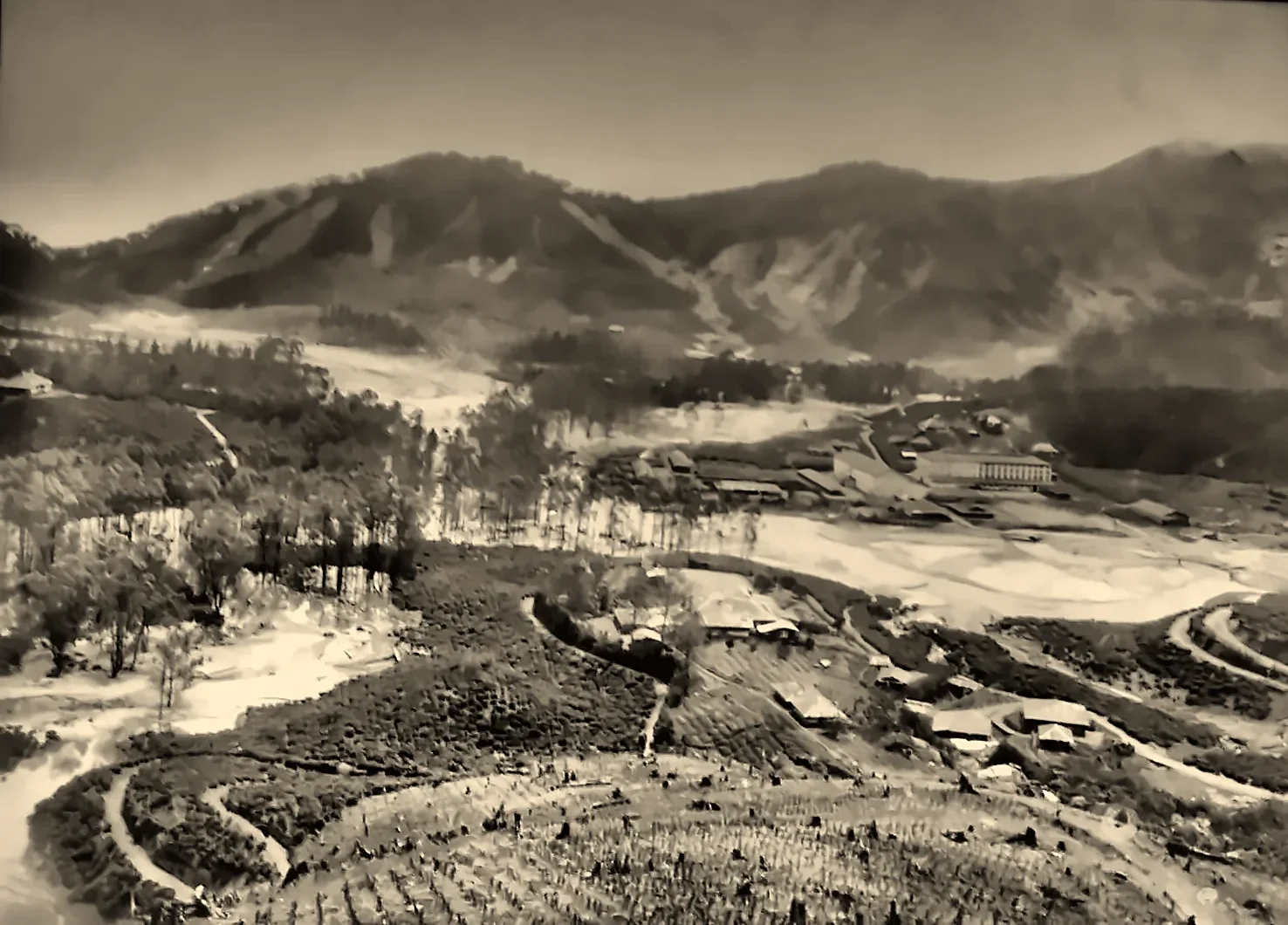
In July 1924, the Great Flood of '99 (1099 in the Malayalam calendar) devastated the High Range. In the hills it destroyed the Kundala Valley Railway and the ropeways. Lower down, it ruined the old road from the plains to Munnar, the route through Pooyamkutty, Karinthiri and Mankulam, often called the old Royal Road. With it went the High Range's link with Kochi: tea, cardamom, pepper and timber could no longer easily reach the port, and the plantations and hill towns were cut off. (Read Karinthiri and the history of Munnar.)
A new road and a new bridge
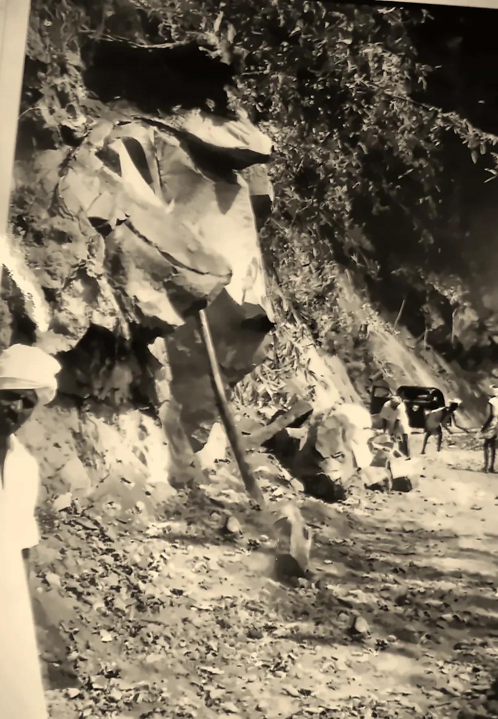
Travancore's response, under the Regent Sethu Lakshmi Bayi (who ruled during the minority of the young Maharaja Chithira Thirunal), was to build an entirely new route: a road from Aluva through Kothamangalam and Neriamangalam, climbing past Adimali to Munnar, along ground less exposed to the floods. The road opened in March 1931, and road works in the hills went on through the 1930s.
The great obstacle was the Periyar at Neriamangalam, a wide, fast river that rises violently in the monsoon. Work on a bridge began in the years after the flood (sources give 1924 or 1928), and it was finally opened by Maharaja Sree Chithira Thirunal on 2 March 1935.
Five arches over the Periyar
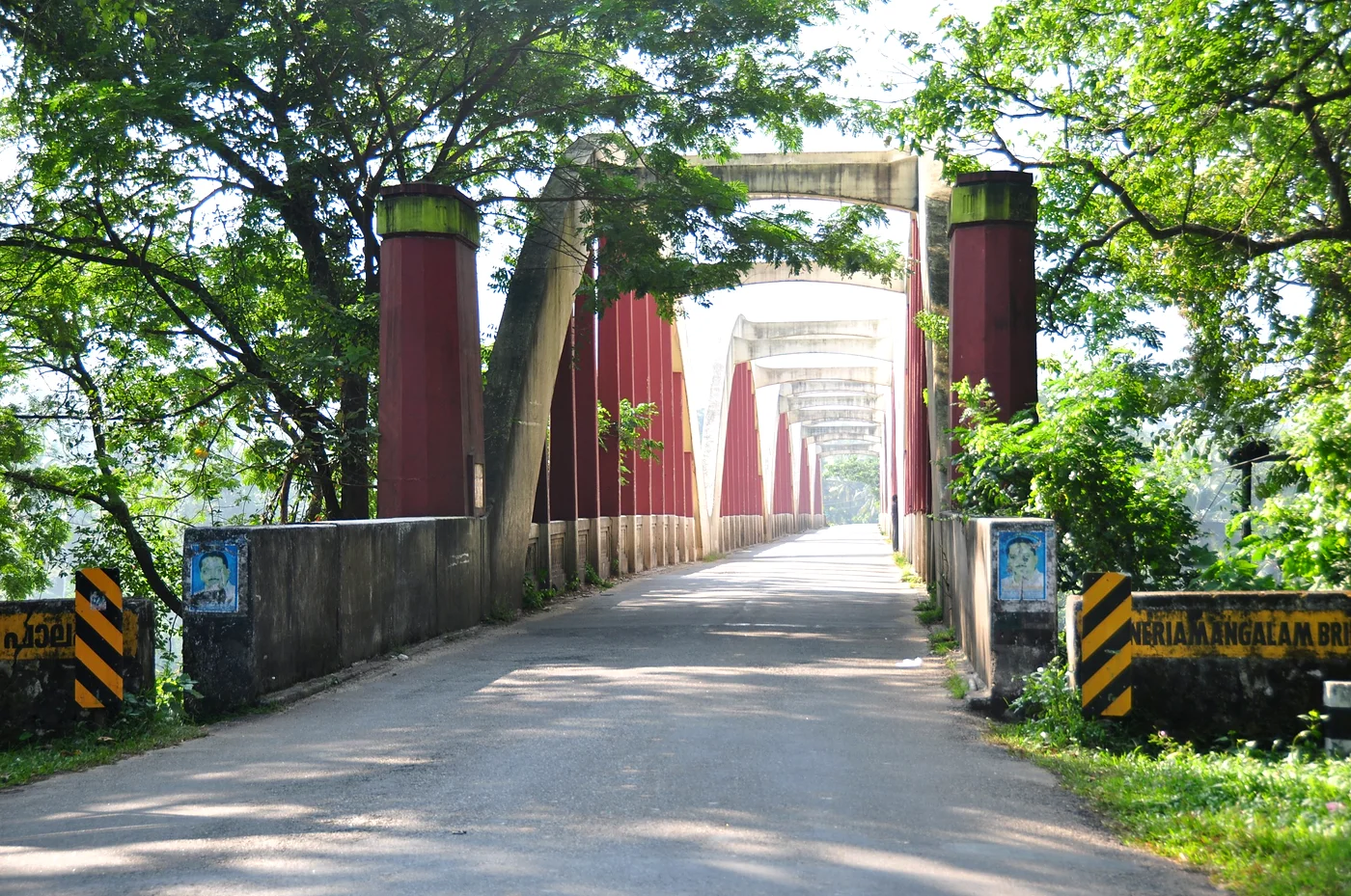
The bridge is about 214 m long, carried on five arch spans between six piers, with the roadway hung between the arches. Its arched form was meant to stand up to the force of the monsoon river. It is often described, especially in Kerala, as the first "Class A" arch bridge in Asia or the first arch bridge in South India; we have not found an engineering source to confirm these titles. Accounts say it was built with traditional surkhi (lime) mortar, mixed with jaggery, together with cement, sand and granite. The roadway is narrow, under 5 m, wide enough for only one large vehicle at a time.
It has stood the test. The bridge came through the great floods of 1961 and 2018, when the Periyar rose to levels not seen since 1924, with little more than routine maintenance in ninety years.
A bottleneck, and a new twin
What was a lifeline in 1935 became a bottleneck in the age of tourist buses and lorries. With only one lane for heavy vehicles, traffic queued at both ends, especially on weekends and in the Munnar season. A new bridge was built alongside, beginning around 2024: a steel bowstring-arch bridge echoing the old design, also 214 m long with five spans of 42 m, but 13 m wide, with an 8 m carriageway and footpaths on both sides. In October 2026 it was reported ready for inauguration. The old arch bridge is to be kept alongside it, a monument to the engineers of Travancore and to the flood that made it necessary.
Visiting
- Where: on NH 85, about 18 km from Kothamangalam and about 60 km from Munnar via Adimali.
- Look for: the view of the arches from the riverbank, and the Periyar flowing below, with the forested hills of Idukki rising beyond.
- Nearby: the Neriamangalam boat jetty and the reservoir of the Bhoothathankettu barrage downstream, the Cheeyappara and Valara waterfalls on the road to Adimali, and Thattekkad bird sanctuary.
- Don't stop on the narrow old bridge; park only where it is safe.
Plan your Idukki journey with GK Global
Neriamangalam is an easy addition to a trip through Idukki's high ranges. From our base in Adimali, the gateway to Munnar, GK Global runs Munnar jeep safaris, elephant-spotting drives and scenic day trips, and helps you find a stay to suit your plans. It is the gateway to the hills on the road from Kochi to Adimali and Munnar.
Explore our jeep safarisFind a staySee it for yourself, with a local driver who knows these roads.
Book a Munnar Jeep SafariSources & further reading
- Wikipedia: Neriamangalam Bridge
- Onmanorama (Oct 2026): British-era engineering heritage makes way for new bridge in Neriamangalam
- Onmanorama (Sept 2026): New Neriamangalam bridge all set to open
- Onmanorama (2019): Idukki's iron man bridges
Figures are from the sources listed and were checked in October 2026. Park timings and road conditions change, so please confirm before you travel.