
Kundala Lake and Dam: The Queen Mother's Reservoir and the Lost Railway of the High Range
High on the road to Top Station, a long lake lies among eucalyptus and tea. Its dam bears the name of a Travancore queen mother, and along its shores once ran a tea railway that a single flood swept away.
At about 1,700 m, where the road from Munnar climbs towards Top Station, the hills open around a long, curving sheet of water. Eucalyptus and wattle crowd its banks, tea bushes march over the slopes above, and early in the morning the lake breathes a white mist that drifts slowly across the road. Pedal boats wait at the jetty, and a Kashmiri-style shikara rocks gently at its mooring. This is Kundala Lake, one of the highest and coolest of Munnar's reservoirs, and one of its quietest stories.
At a glance
- Where: Kundala, in Mattupetty panchayat, about 20–25 km from Munnar on the road to Top Station.
- Altitude: about 1,700 m.
- The dam: officially Setuparvatipuram Dam; a masonry gravity dam about 37 m high and 259 m long on the Muthirapuzha river, completed in 1947.
- Purpose: storage for the Pallivasal hydroelectric scheme, Kerala's first.
- Today: a KSEB hydel tourism boating centre.
A dam named for a queen mother
When the Travancore government built Kerala's first hydroelectric station at Pallivasal in 1940, its engineers soon wanted more water in the dry months. High upstream, at Kundala, the Muthirapuzha flowed out of a broad, marshy valley, a natural place to store the monsoon rains. A masonry dam was raised across it in the 1940s and completed in 1947, the last year of British India. It was named Setuparvatipuram in honour of Maharani Sethu Parvathi Bayi, the mother of the last Maharaja of Travancore, Sri Chithira Thirunal, in whose reign the Pallivasal project was carried out.
The dam holds about 7.65 million cubic metres of water. Released, it flows down to the larger Mattupetty reservoir and on, by tunnel and pipe, to the turbines at Pallivasal. (Read the Pallivasal story and Mattupetty and the Indo-Swiss project.)
A word on a popular claim: many tourist websites, and even some official pages, describe Kundala as "Asia's first arch dam". The Kerala State Electricity Board's own dam-safety records list it as a masonry gravity dam, which holds back water by its weight rather than by an arch. The claim is best treated as a tourist legend.
The railway the flood took away
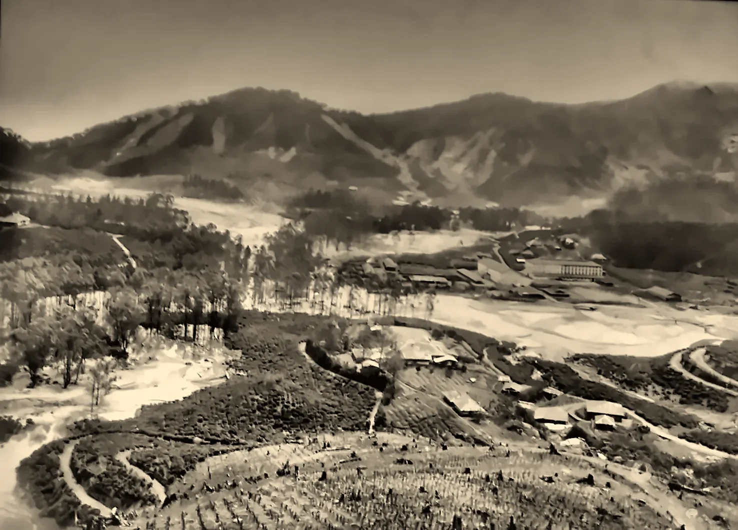
Long before the dam, Kundala was a busy place. In 1902, the planters of the Kannan Devan Hills opened the Kundala Valley Railway, first as a curious monorail: small carriages balanced on a single rail, steadied by a large wheel running on the road and drawn by bullocks. In 1908 it was rebuilt as a 2-foot narrow-gauge light railway, with little steam engines puffing between Munnar, Madupatty (Mattupetty) and Palaar to Top Station, about 35 km in all. From Top Station, an aerial ropeway lowered the tea down the cliffs to Kottagudi in Tamil Nadu, and carts carried it on to the railway at Bodinayakanur.
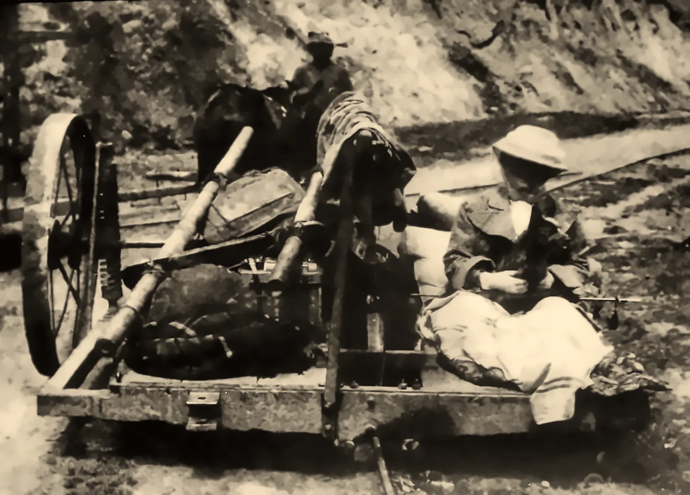
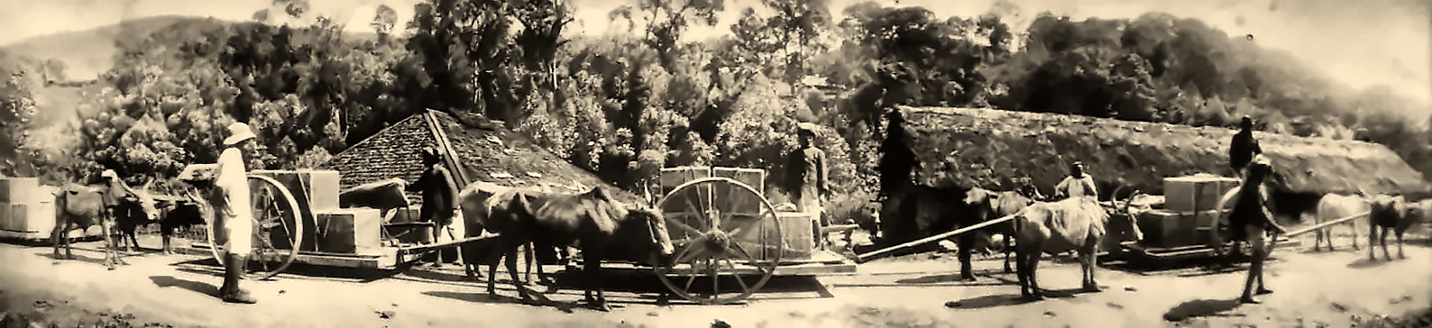
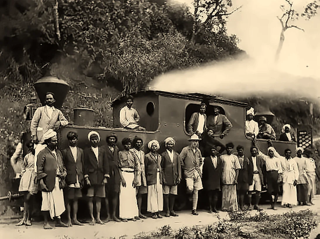
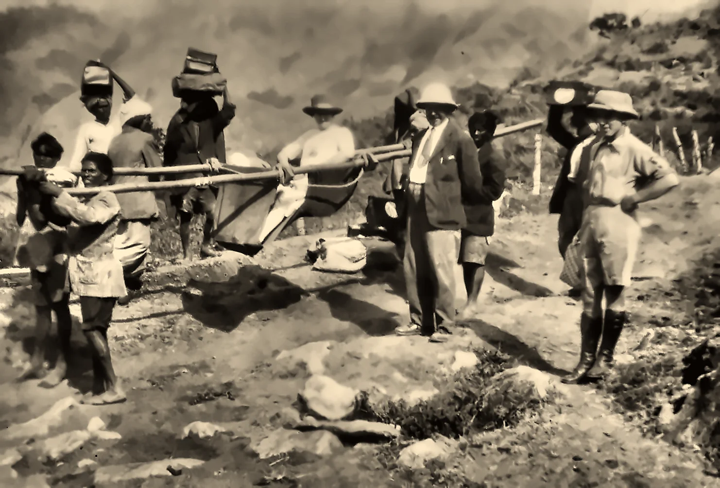
Then came the Great Flood of 1924, the "flood of '99" in the Malayalam calendar. Landslides and torrents swept away tracks, bridges and stations across the High Range, and the railway was never rebuilt. A few traces survive: the old Munnar station building, now a Tata Tea office, and stretches of road that follow the old line. Plans to revive a heritage railway have been discussed by Kerala Tourism in recent years. (Read the history of Munnar.)
The lake today
The Kundala reservoir is now run as a hydel tourism boating centre by the KSEB. Pedal boats, row boats, a slow-speed motor boat and Kashmiri-style shikaras take visitors out onto the water, and kayaks and coracles are sometimes on offer too. On a calm morning, with mist rising off the water and the hills mirrored in it, a slow row across the lake is one of the gentlest pleasures of Munnar.
The banks are planted with eucalyptus and wattle, relics of the plantation era, and above them the Kundala tea estate covers the slopes. In the cool season, ornamental cherry trees around the lake and estate bloom pink, a sight that draws photographers. The surrounding hills belong to the Neelakurinji country, and in a flowering year their slopes turn blue. (Read Neelakurinji.)
Wildlife comes down to the water too. Wild elephants are regular visitors to the Kundala and Mattupetty shores, especially in the dry months, and gaur graze on the grassy slopes at dawn and dusk. Watch from a distance, and never approach them. (Read Munnar's wildlife.)
On the road to Top Station
Kundala lies on one of the most beautiful drives in Kerala. Coming from Munnar, you pass the Mattupetty dam and the Echo Point before reaching Kundala; beyond it, the road climbs through tea and eucalyptus to Top Station on the very edge of the Ghats, and on through the Pampadum Shola to the farms of Vattavada.
Visitor's guide
- Getting there: about 20–25 km (45 minutes to an hour) from Munnar via Mattupetty.
- Boating: generally from about 9:30 am to 5 pm, with a short break at lunchtime; rates are set by the KSEB hydel tourism centre and change from time to time.
- Best time: September to March for clear weather; mornings are calmest and most misty. It is cold here: carry a warm layer.
- Wildlife: elephants may be on or near the road, especially early and late in the day; keep a safe distance and stay in your vehicle.
Plan your Idukki journey with GK Global
Kundala Lake is an easy addition to a trip through Idukki's high ranges. From our base in Adimali, the gateway to Munnar, GK Global runs Munnar jeep safaris, elephant-spotting drives and scenic day trips, and helps you find a stay to suit your plans. Our Top Station jeep safari follows this road past Mattupetty, Echo Point and Kundala on its way to the edge of the Ghats.
Explore our jeep safarisFind a staySee it for yourself, with a local driver who knows these roads.
Book a Munnar Jeep SafariSources & further reading
- KSEB Dam Safety: Kundala dam
- Wikipedia: Kundala Dam
- Kerala Hydel Tourism: Kundala Dam boating centre
- Wikipedia: Kundala Valley Railway
Figures are from the sources listed and were checked in October 2026. Park timings and road conditions change, so please confirm before you travel.